
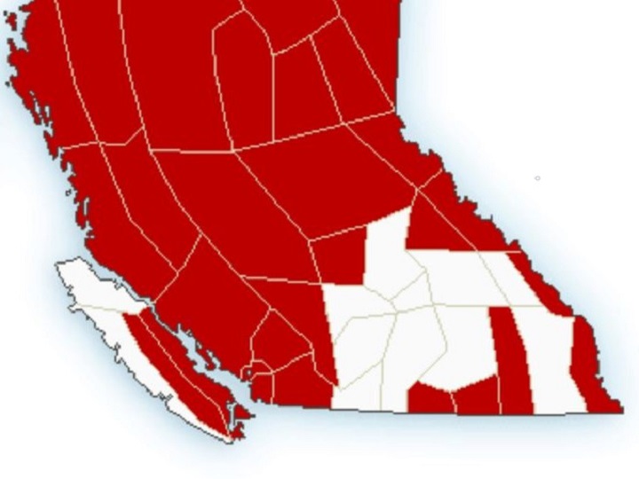
Environment Canada has issued a handful of weather warnings for regions in B.C.’s Southern Interior.

The national weather service says winter storm warnings are in effect for the Boundary, West Kootenay and Kootenay Lake regions.
A Pacific storm is forecast to bring heavy snow to Highway 3, Paulson Summit to Kootenay Pass, beginning this evening,” Environment Canada said in the warning, which was issued at 4:01 a.m., on Wednesday.
“Snow will continue through Thursday then taper off Thursday night. Total snowfall accumulation of 30 centimetres is expected with this event.”
For the Elk Valley region, an extreme cold warning is in effect. Bitterly cold arctic air and winds could see wind-chill values fall to -35 C.
No weather warnings were issued for the Similkameen, Nicola, Okanagan, Shuswap, West Columbia, East Columbia and Arrow Lakes regions.


However, periods of snow are expected for those regions, with two to four centimetres projected.
Environment Canada says the snow could start falling in the afternoon, along with 20 km/h winds from the north, and continue overnight before ending Thursday morning.
Temperatures are expected in the -11 to -13 C range for Wednesday, with Thursday reaching highs of -4 (South Okanagan) to -8 (Central and North Okanagan, Shuswap) and overnight lows of around -13.

Comments