
Clouds will build back into the Okanagan on Thursday after temperatures dipped to 3 degrees to start the day.

Pockets of rain are possible during the afternoon, as the valley bottom warms into the low teens.
Showers continue off-and-on through the evening hours before a brief break slips through into early Friday, with sunny breaks possible to start the day before the mercury makes a break for double digits.
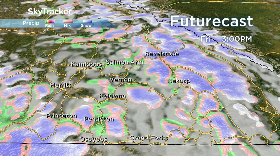
By Friday afternoon, the rain-risk returns with mountain snow likely, as freezing levels sit around 1,300 to 1,500 metres, which will affect the Okanagan Connector and Allison Pass heading into the weekend.
Pockets of valley bottom rain and mountain snow continue into early Saturday, along another upper trough, but precipitation should ease in the afternoon before returning with more clouds late Sunday.


Daytime highs over the weekend and into next week will continue to sit in high single digits or low double digits.
Election Day Monday will be a bit damp, with yet another frontal boundary bringing more waves of rain — an unsettled trend that will linger into Tuesday as well.

For weather on the go download the Global News SkyTracker Weather App for iPhone, iPad or Android.
- Honda expected to announce Ontario EV battery plant, part of a $15B investment
- Trudeau says ‘good luck’ to Saskatchewan premier in carbon price spat
- Canadians more likely to eat food past best-before date. What are the risks?
- Hundreds mourn 16-year-old Halifax homicide victim: ‘The youth are feeling it’
Comments