
After a cool and damp start to the week, temperatures returned to the low 20s by mid-week, which is where the mercury will stay heading into the weekend.

Clouds hung around on Thursday morning and lingered into the afternoon, with an onshore flow continuing to bring in overcast conditions as the region warms into the low 20s.
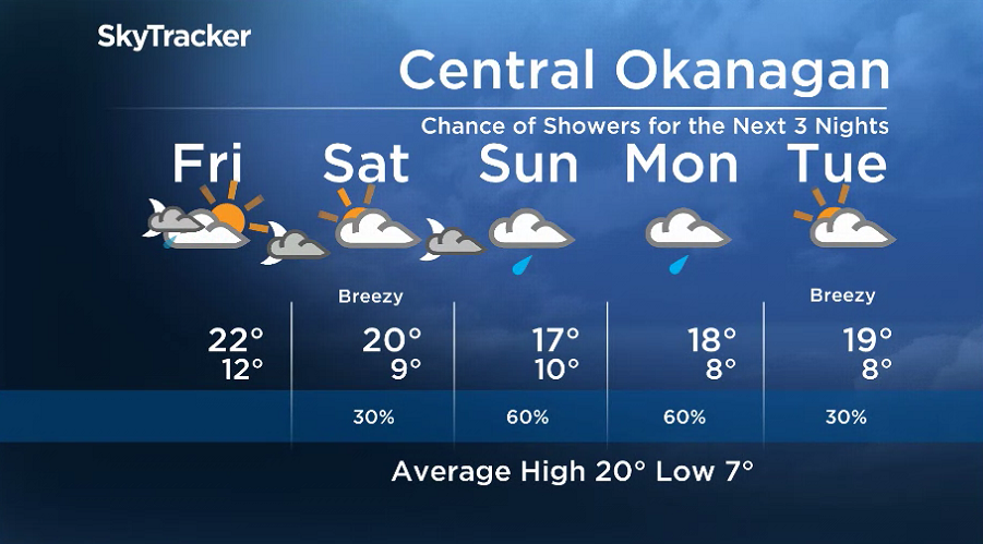
Showers are possible Thursday night and into early Friday morning before skies start to clear, with sunny breaks possible by morning as conditions cool back into low double digits.
The next round of clouds will roll in along a cold front during the day, with a chance of evening showers after hitting a high around 22 degrees.
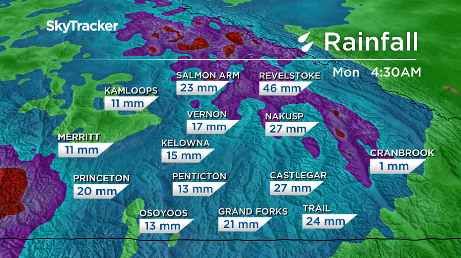
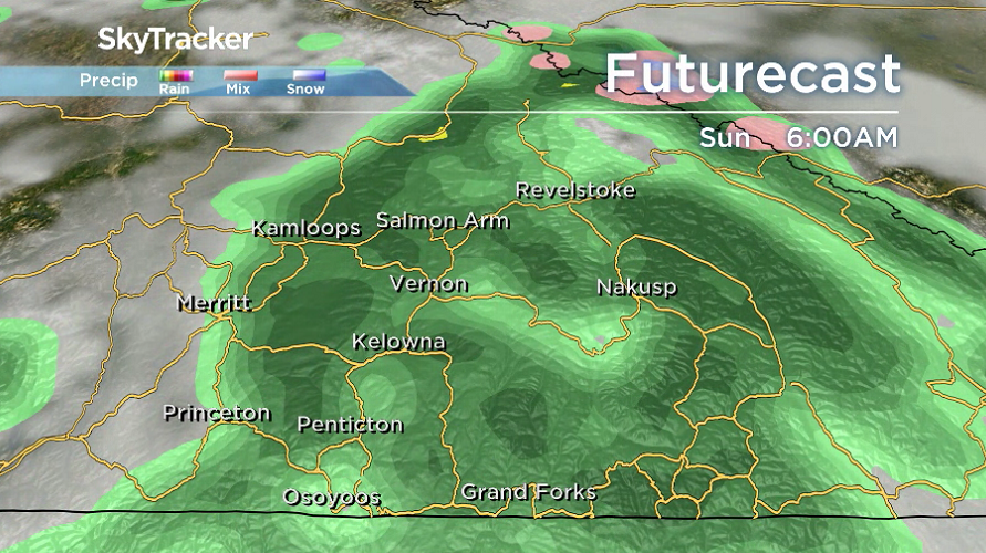
The moisture feed continues into the weekend, with a slight chance of showers on Saturday and more organized rain pushing in Sunday and Monday along an upper trough.


Afternoon temperatures should manage to make it into the low 20s on Saturday before sinking back into the high teens on Sunday and heading into next week.
Showers start to ease off into Tuesday, with lingering clouds during the day before sunshine and 20 degree heat returns by the middle of the week.
For weather on the go download the Global News SkyTracker Weather App for iPhone, iPad or Android.
Comments