
After a hot, 30-degree finish to the third weekend of August, temperatures took a bit of a slip back toward single digits Monday morning in the clear conditions.

Beautiful blue skies and sunshine kicked back in during the day as the valley warmed into the mid-20s by late in the morning before soaring into the high 20s in the sun for an afternoon high.
Another mostly clear night allows the mercury to dip back into low double digits overnight before sunshine returns to start the day on Tuesday followed by some clouds returning during the afternoon.
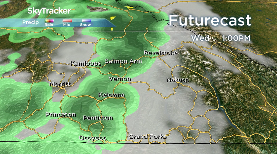
Temperatures are expected to spike up to 32 degrees late on Tuesday before a cold front ushers back in the clouds on Wednesday. With the cold front comes a chance of showers late in the day.
READ MORE: Northern B.C. gets up to 1 foot of snow this weekend

Ahead of the front, the region should manage to make it back into the high 20s with parts of the South Okanagan climbing into the low 30s in the afternoon.


Behind the front, on Thursday there will be cooler conditions with a mix of sun and cloud and a slight chance of a spotty sprinkle as daytime highs get dunked back into the mid-20s.
The mid-20s is where afternoon highs are expected to linger Friday and into the weekend with a few more clouds to finish the week before partial sunshine returns into the weekend.

For weather on the go download the Global News SkyTracker Weather App for iPhone, iPad or Android.
- Canadian man dies during Texas Ironman event. His widow wants answers as to why
- On the ‘frontline’: Toronto-area residents hiring security firms to fight auto theft
- Honda’s $15B Ontario EV plant marks ‘historic day,’ Trudeau says
- Canadians more likely to eat food past best-before date. What are the risks?
Comments