

After a month’s worth of rain falls in Saskatchewan, more is on the way.

Weather forecast
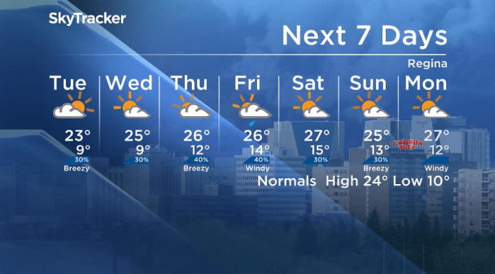
Monday
Following a major wallop of a month’s worth of rain in parts of Saskatchewan in the past week, slightly drier conditions slid in Monday morning as temperatures snuck into single digits to start the week.
There is a good chance of showers and the risk of a thunderstorm in Saskatoon during the afternoon with a slight chance in the Regina area as the mercury climbs into the low 20s for a daytime high.
Monday night
Skies clear back out Monday evening as conditions cool back into single digits overnight.
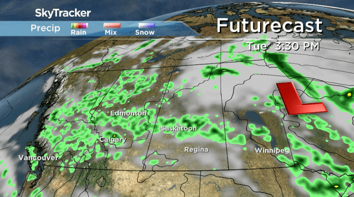
Tuesday
Lingering instability will last in parts of central Saskatchewan Tuesday afternoon with a chance of showers and risk of thunderstorms as just a slight chance sticks around in the Regina area.
Clouds will build into both cities during the day after some sunshine in the morning with an afternoon high back in the mid-20s.
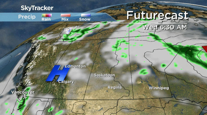
Wednesday-Friday
Partly-to-mostly cloudy skies linger for the rest of the final week of June with a good chance of showers and risk of a storm on Friday as a low-pressure system pushes into the province.
Daytime highs will stay in the mid-20s with a gusty wind picking up on Friday.
Canada Day long weekend outlook
Canada Day long weekend will begin on an unsettled note with a chance of showers and risk of a thunderstorm on Saturday before drier and sunnier conditions return with daytime highs in the mid-20s.


Rocanville was the setting for Grace Deptuck to take the Your Saskatchewan photo for June 24:

The Saskatchewan weather outlook is your source for the province’s most accurate forecast and is your one-stop shop for all things weather with comprehensive, in-depth analysis that you can only find here.
For weather on the go download the Global News SkyTracker Weather App for iPhone, iPad or Android.
Comments