

The first major thunderstorm of the season rolled through central and southern Alberta Thursday, including one cell that had Global viewers pulling out their cameras.

The signs of an energetic system were in place early in the day, and Environment and Climate Change Canada (ECCC) responded by issuing a number of severe thunderstorm watches in the morning.
By mid-afternoon many of those watches were upgraded to warnings, including for the city of Calgary.
According to ECCC meteorologist Dan Kulak, the line of thunderstorms that moved north of Calgary was not unusual in nature, and is really just a sign of what to expect as we head into thunderstorm season.
However, with such massive systems one often doesn’t get such a clear view of the actual precipitation shaft, because that is usually wrapped , or obscured, by rain.
Because this one was so defined, many Calgarians took to social media and emailed Global Calgary with their photos.


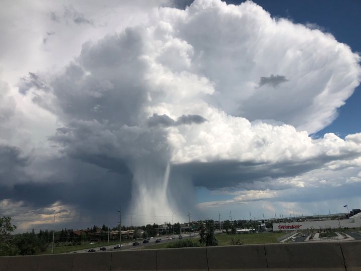


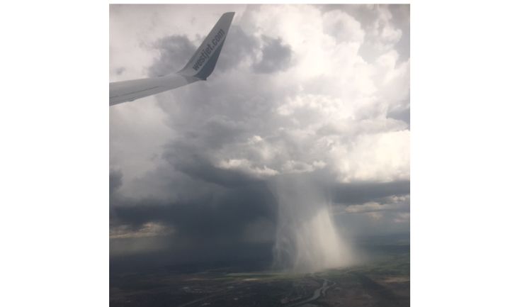
The actual phenomenon of what was happening in these pictures is quite typical. This was a tall supercell thunderstorm that had intense updraft winds that were cooling rapidly. Eventually as the cloud reached maximum saturation levels, the updraft collapsed and all of the hail and rain literally fell out of the bottom of the cloud, leaving a portion of the cloud base intact. This would be similar to filling a balloon full of water until it could no longer maintain its shape and the water forcefully bursts out of the bottom.


Many of the pictures show a whitish coloured centre of the downdraft, indicating this was a hail shaft.
WATCH: Viewer captures time-lapse of cloudburst in Calgary

According to reports, the wind associated with this particular cell were not overly strong. Occasionally the downdraft wind speeds in systems like this can reach over 160 km/h and cause significant damage on the ground.
“Most of the hail that came from this storm was insignificant,” said Kulak, “although quarter-size hail was reported near the Cottonwood Golf and Country Club southeast of Calgary.”
Want your weather on the go? Download the Global News Skytracker weather app for iOS and Android.
Comments