
Twenty degree daytime highs returned to the Okanagan through the first weekend of May with sunshine rolling in across the region.

It was a sunny start to the first full week of May with temperatures dipping back to 5 degrees to start the day before bounding into the upper teens before noon.
The mercury continues to soar into the low 20s Monday afternoon as clouds slide back in with a chance of showers during the evening hours.
Five degrees is where temperatures will fall to as clouds clear out into the early morning hours before the valley warms back up to around 23 degrees Tuesday afternoon under mostly sunny skies.
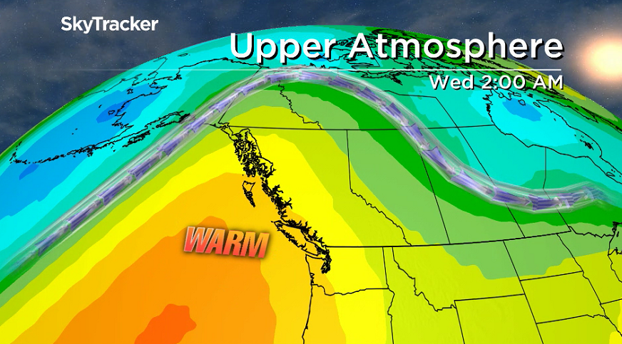
Clouds roll back in Tuesday night and linger into Wednesday morning with a very slight chance of showers before skies clear back out Wednesday afternoon with an afternoon high in the mid-20s.

A large upper ridge of high pressure builds in for the rest of the week with a return to mostly sunny skies and daytime highs surging from the mid 20s on Thursday to the upper 20s or low 30s in some areas Friday and Saturday.


Freezing levels will soar upwards of 3000 metres heading into the weekend, meaning alpine snow melt will accelerate with river levels expected to rise into next week.

For weather on the go download the Global News SkyTracker Weather App for iPhone, iPad or Android.
- Life in the forest: How Stanley Park’s longest resident survived a changing landscape
- Bird flu risk to humans an ‘enormous concern,’ WHO says. Here’s what to know
- More youth are seeking EI amid rising unemployment rates: StatCan
- Mental health support still lacking 4 years after mass shooting: Nova Scotia mayor
Comments