
After a below seasonal weekend with some snow early Saturday in Vernon and a breezy northerly wind keeping conditions cool on Sunday, temperatures fell below freezing for a frosty start to the week in the Central and South Okanagan.


The mercury managed to make it up into double digits by noon as sunshine stayed in the valley with towering cumulus clouds over the ridgetops.
Those clouds will continue to drop precipitation over higher elevation areas and are likely to sneak into the valley bottom bringing the chance of a spotty sprinkle and the risk of a thunderstorm.
After warming into the low teens for an afternoon high, skies start to clear as temperatures fall back toward and likely below freezing overnight with a risk of frost.
Sunshine kicks off the morning on Tuesday before clouds roll back in later in the day as the valley warms up into the mid-teens for an afternoon high for the final day of April.


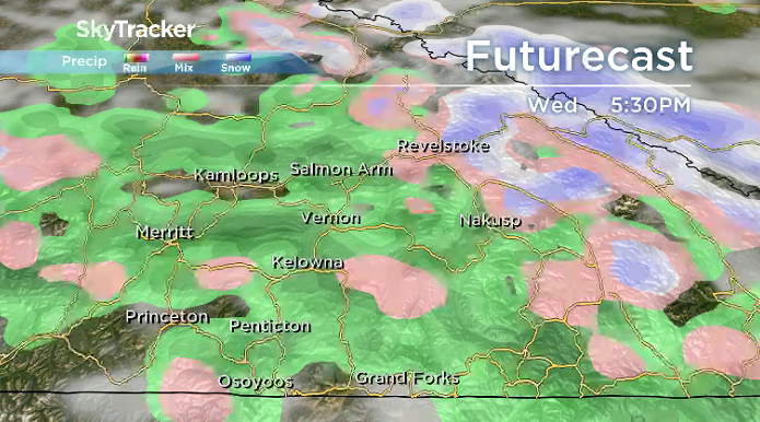
May begins on Wednesday with mostly cloudy skies and a chance of showers both early and late in the day with an afternoon high back in the mid-teens.
Unsettled conditions linger into Thursday with partly-to-mostly cloudy skies and a chance of showers, but daytime highs will bump up a few degrees further.
High double digits should be reached to wrap up the work week on Friday with sunshine to start the day and clouds rolling back in during the afternoon.
The weekend will bring a mix of sun and cloud back into the forecast picture with daytime highs hovering around 17 degrees.

For weather on the go download the Global News SkyTracker Weather App for iPhone, iPad or Android.
- Roll Up To Win? Tim Hortons says $55K boat win email was ‘human error’
- Bird flu risk to humans an ‘enormous concern,’ WHO says. Here’s what to know
- Halifax homeless encampment hits double capacity, officials mull next step
- Ontario premier calls cost of gas ‘absolutely disgusting,’ raises price-gouging concerns
Comments