
Valley cloud that dominated much of the weekend continued into the work week with some pockets of light snow sliding through Monday morning.

Temperatures started out the second full week of 2019 just shy of the freezing mark, but are slated to swing up a few degrees above it by afternoon.
The upper ridge of high pressure bringing in the valley cloud, an inversion and high elevation sunshine will hold in place into early Tuesday before weakening later in the day, helping break up the valley cloud a bit.
Depending on the exact timing of the holes getting carved out of the low stratus cloud will determine exactly how warm it’ll get Tuesday afternoon, but after starting the day out a few degrees below freezing, the mercury should make it up to around +2.

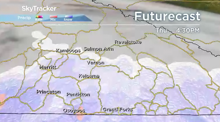
A push of higher clouds will crawl in on Wednesday with an afternoon high just above freezing once again before a strong system sliding up the coast pushes in a good chance of snow on Thursday.

Accumulations of a few centimetres are possible in some areas into early Friday, but the risk of rain and snow at times continues right into the weekend.
Daytime highs should manage to still swing up above freezing by a few degrees through the remainder of the week and into the weekend with morning lows around or just below zero.

For weather on the go download the Global News SkyTracker Weather App for iPhone, iPad or Android.
Comments