
The clouds that rolled in on Sunday, bringing rain to the region, will stick around on Monday across the Okanagan.

After a sunny Saturday, there were some lingering showers and snow at high elevations early in the day. This followed a winter wallop of heavy snow, which hit the mountains over the weekend.
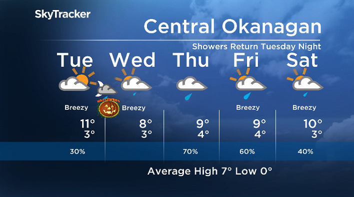
After making it a few degrees into double digits Monday afternoon in the clouds, some clear breaks roll in overnight into early Tuesday, allowing temperatures to cool back toward the freezing mark.
A mix of sun and cloud starts off the day as the valley sits between systems on Tuesday with an afternoon high in low double digits.

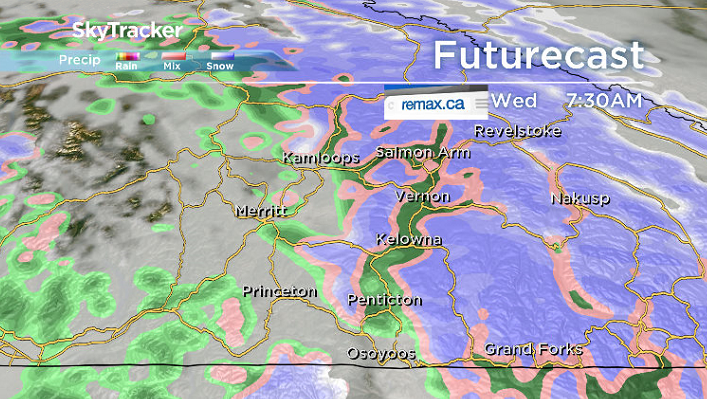
The next wave of clouds rolls in late Tuesday and brings in rain and high elevation snow into early Wednesday.
The rain will stick around into Halloween morning before easing during the afternoon in the Central Okanagan, just in time for trick-or-treaters.
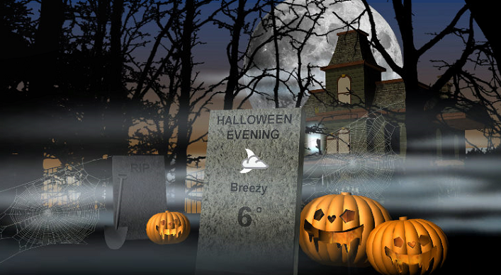
Trick-or-Treating temperatures are expected to be around 6 or 7 degrees early Wednesday evening with partly to mostly cloudy skies and a chance of some lingering showers in the North Okanagan, Shuswap, Revelstoke and Arrow Lakes areas.


Rain returns for the first day of November on Thursday, picking up in the afternoon with a daytime high hoping to hop up near double digits.

Yet another system will build in some showers on Friday with another round of rain potentially pushing through both on Saturday and Sunday with afternoon highs close to or just into double digits.
For weather on the go download the Global News SkyTracker Weather App for iPhone, iPad or Android.
- Budget 2024 failed to spark ‘political reboot’ for Liberals, polling suggests
- Train goes up in flames while rolling through London, Ont. Here’s what we know
- Peel police chief met Sri Lankan officer a court says ‘participated’ in torture
- Wrong remains sent to ‘exhausted’ Canadian family after death on Cuba vacation
Comments