


As the flooding threat continues in B.C., and thousands have been forced from their homes, Global News is tracking where the flooding is impacting communities.

Almost 3,000 residents remain on evacuation order, including those who live on about 400 properties in Grand Forks.
READ MORE: Meetings for flooding updates in Grand Forks, Rock Creek
The West Kettle River, which flows into the Kettle River, is affecting many regions, especially Grand Forks.
The Kettle River then joins the Granby River before it flows into the U.S.
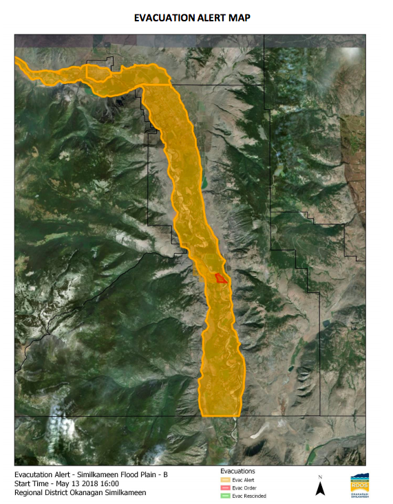
Also at risk are communities near the Similkameen, starting as it comes out of Manning Park, flowing past Princeton, where it joins the Tulameen River, past Hedley, Keremeos and Cawston.
WATCH: A map showing you where the flooding is occurring in B.C.

In the Regional District of Kootenay Boundary, here is a look at the addresses impacted by the flooding (click the map to zoom in and move around):
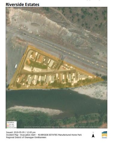
Regional District of Okanagan Similkameen
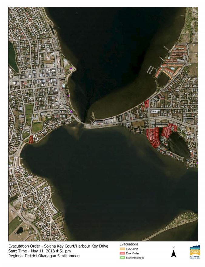
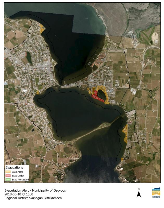
Evacuation order for the following addresses in Osoyoos:
- B.C. child-killer’s attempt to keep new identity secret draws widespread outrage
- Inquest hears B.C. hostage was lying on her captor before fatal shooting
- ‘We’ve had to make a 180’: What Oregonians say they got wrong with decriminalization
- B.C. judge grants shared custody of family dog in landmark ruling
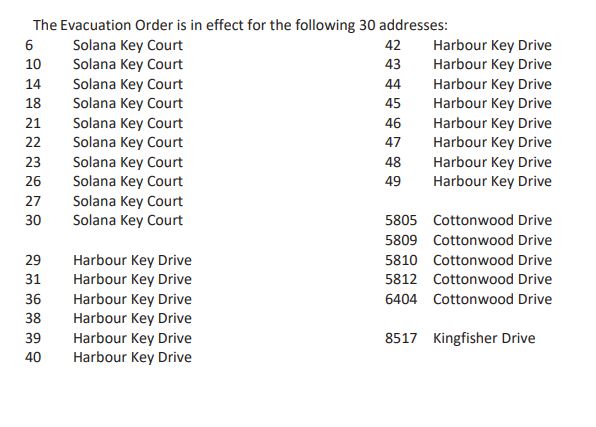
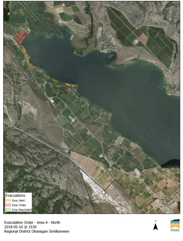
Another 23 properties on Harbour Key Drive and Solana Key Court, the Coast Hotel in Osoyoos and 17 properties in rural Electoral Area ‘A’ have also been evacuated.
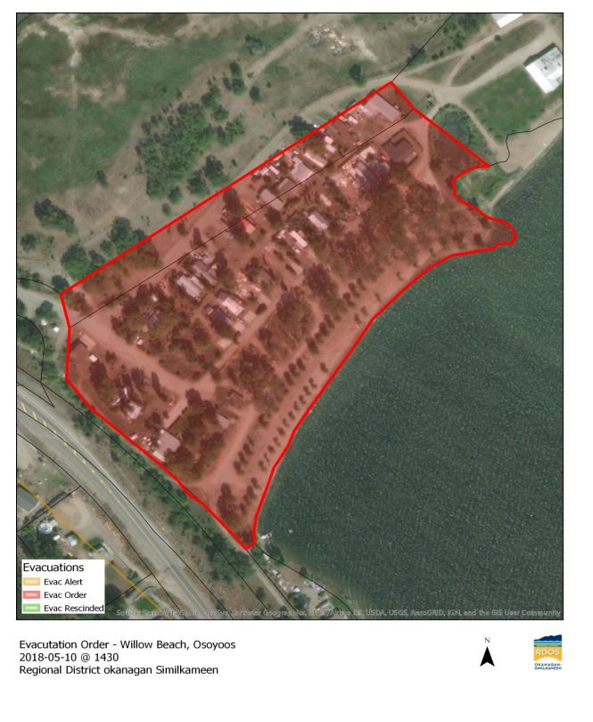
Evacuation order for Willow Beach area:
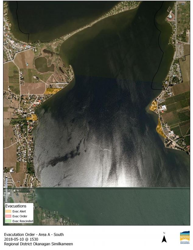
Evacuation alert maps for properties on Osoyoos Lake:


Evacuation Alert For Properties along the Similkameen River:
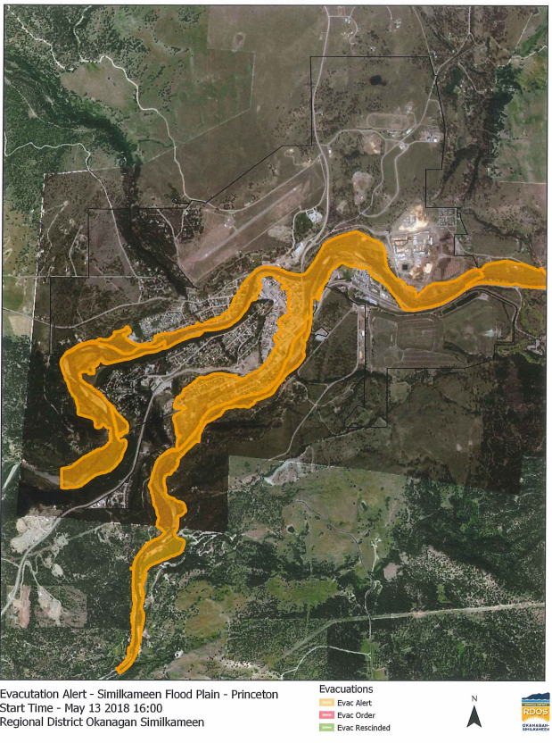
Princeton properties along the floodplains of the Tulameen and Similkameen River Valley are under an evacuation alert. Click here for the full list of affected addresses.
READ MORE: Hundreds issued evacuation alert in Princeton
The Lower Similkameen Indian Band has issued an evacuation alert.
Comments