
A blast of snow before arctic air plunges back in.

Snowfall Warning
Environment Canada has issued a snowfall warning for Prince Albert, Melfort, La Ronge, Meadow Lake and other parts of north-central Saskatchewan for 10 to 15 centimetres of snow on Tuesday.
Heavy snow will move into western Saskatchewan Tuesday morning and spread eastwards into eastern Saskatchewan by the afternoon before moving out in the evening.
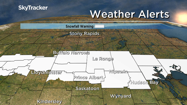
Pockets of higher amounts of snow in the 15 to 20 centimetre range will be possible depending on small, localized features that may develop within this storm.
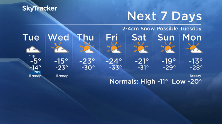
As the snow comes to an end, very cold arctic air will return to the region with gusty northwesterly winds sending daytime highs back into the -20s and overnight lows near or below -30 with some regions expected to see extreme cold warnings return Wednesday night.
For the latest weather alerts, download the Global News SkyTracker weather app for iPhone, iPad or Android.
Saskatoon Forecast
Monday
After a very mild first weekend of 2018 with temperatures popping above freezing Sunday, slightly cooler air has moved in to start the second week of the year.
We started the day around -8, which is warmer than a normal daytime high for Jan. 8, with clouds lingering through the morning as we warmed up to -5 before noon.
During the afternoon the climb continued with a daytime high a few degrees shy of the freezing mark under mostly cloudy skies.
Tuesday
It’ll feel like the mid-minus teens with wind chill to start the day with a slight chance of freezing drizzle, which could make for a slick morning commute.
The low pressure system will swing through and keep conditions mild during the day with an afternoon high again in mid-minus single digits, but it’ll bring in some snow, which will pick up in the afternoon.

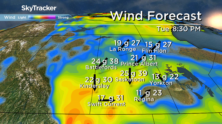
Northerly winds will kick in during the evening with gusts upwards of 40 to 50 km/h as arctic air surges in and drops the mercury into the minus teens.
Wednesday-Friday
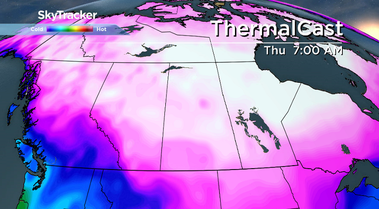
Some clouds will hang on for Wednesday before we get into increasing sunshine Thursday and Friday as an arctic high pressure system drops in and knocks us back into the deep freeze.


Daytime highs will drop into the -20s with overnight lows into the -30s and morning wind chills potentially approaching extreme warning criteria of the -40s Thursday and Friday.
Weekend Outlook
The big question this weekend will be how long will the extreme cold hang on?
Some models are bringing in a biy of a warm up into the minus teens with morning lows in the -20s, but we have opted for the cooler version, which other models are suggesting, which will keep lows around the -30 degree mark.
We will keep a close eye on the situation and have a much better idea as to the most probable outcome in the coming days.
Albert Sikma took the Your Saskatchewan photo for Jan. 8 at Island View:

READ MORE: Get a 2018 Your Saskatchewan Calendar today
Saskatoon weather outlook is your source for Saskatoon’s most accurate forecast and is your one stop shop for all things weather for central and northern Saskatchewan with comprehensive, in depth analysis that you can only find here.
Comments