


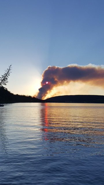
For the first time in 14 years, the province has declared a state of emergency as a number of wildfires burn out of control, leading to the evacuation of more than 38,000 people across B.C’s interior and Cariboo regions..

Evacuation orders have been issued for the communities of Ashcroft, Cache Creek, Princeton, 105 Mile House and 108 Mile House, while other communities have been placed under evacuation alert, such as 100 Mile House and 150 Mile House.
The BC Wildfire Service rates the fire risk as high to extreme in much of the province and Environment Canada says daytime maximum temperatures will reach the mid to upper 30s in some regions through the weekend.
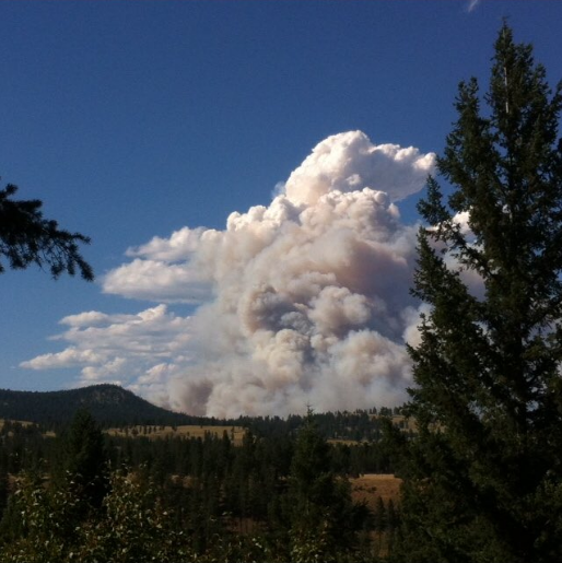
There were are more than 180 fires burning around the province on Saturday, according to the B.C. Wildfire Service.
The service said there were 138 confirmed wildfire starts in one day across the province, mostly in the central Interior.
“Lightning, high temperatures and strong winds were contributing factors,” it said in a tweet.
WATCH: 171 wildfires burning across British Columbia: Fire official

B.C.’s chief fire information officer Kevin Skrepnik said the situation is fluid and volatile.
“Given the sheer number of ignitions yesterday and given the fact that I’m not anticipating any changes in the weather over the next few days, we expect this level of activity is going to continue and we’re likely going to be having new fires of concern into the next few days,” he said.
Coverage of B.C. wildfires on Globalnews.ca:


Here is a look at the B.C. wildfires by the numbers:
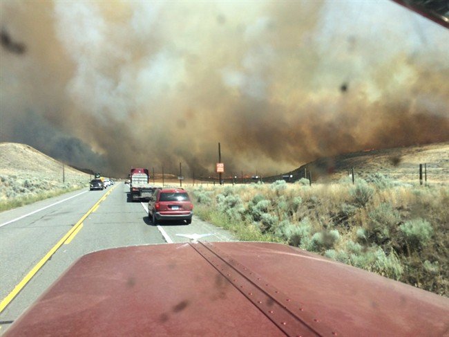
Number of fires: More than 173 fires were reported on Friday alone, with fire crews battling 183 blazes across the province at one point on Saturday.
Locations: Crews focused Saturday on two of the largest fires that forced thousands from their homes in the communities of Ashcroft, Cache Creek, 100 Mile House, 105 Mile House and 108 Mile House and 150 Mile House.
Firefighters on scene: More than 1,000, supported by about 600 support staff, along with heavy equipment and helicopters. Minister of Forests Lands and Natural Resources John Rustad said Saturday that another 260 out-of-province personnel are expected by Monday or Tuesday.
Evacuees: Precise numbers for the entire province were not released, but the Cariboo Regional District estimates as many as 6,000 people were forced from their homes. Rustad said at least 3,000 households across the Cariboo, Princeton, and Ashcroft regions have been evacuated.
Structures burned: Officials have not released figures, but Cache Creek Mayor John Ranta said a fire burning between Ashcroft and Cache Creek destroyed dozens of buildings, including at least five houses, 30 trailer park homes and two hangars at a regional airport. Eight of the fires burning in the province were threatening homes or other structures. Rustad said smoke and fog are preventing crews from doing an accurate accounting of the damage.
Fire sizes: Crews are currently battling five fires larger than 10 square kilometres (1,000 hectares):
- Ashcroft Reserve: 40 square kilometres,
- Gustafsen wildfire, near 100 Mile House: 32 square kilometres
- 150 Mile House: 20 square kilometres
- Princeton: 10 square kilometres
- Williams Lake Airport: 10 square kilometres
Here are some of the most notable fires:
100 Mile House
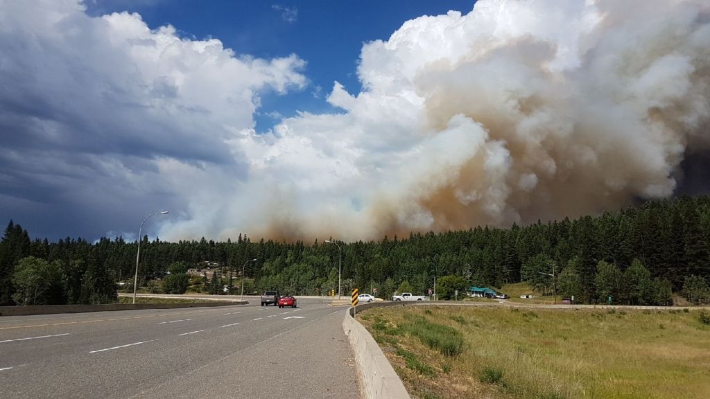
A wildfire burning about seven kilometres west of 100 Mile House has expanded from 1,800 hectares Friday night to to 3,200 hectares as of 3 p.m. Saturday.
The fire, which flared up near the Gustafsen North Forest Service Road, is zero per cent contained.
Smoke is making it difficult to determine its exact size.
Ashcroft/Cache Creek
An estimated 4,000-hectare fire is burning on the Ashcroft Reserve.
It grew from 700 hectares to that size in approximately five hours on Friday.
“Structures have been impacted by the fire,” according to the BC Wildfire Service, but visibility is so poor it’s difficult to determine how many structures have been affected.
Widespread evacuation orders have been issued to people in Ashcroft and the entire village of Cache Creek. Ashcroft Hospital has also been temporarily closed.
A spokesperson for the Thompson-Nicola Regional District said 236 properties from the areas of North Ashcroft, Little Fort and SW Little Fort have been evacuated.
All affected residents are being asked to check in at the McArthur Island Recreations Centre in Kamloops.


A public meeting will be held at Thompson Rivers University at 7 p.m.
Princeton
A wildfire has flared up along Highway 5A near Princeton, forcing the evacuations of 60total properties, including a children’s camp, between Summers Creek Road and Dry Lake, according to the Okanagan-Similkameen Regional District.
The fire is estimated at over 200 hectares in size.
Properties subject to evacuation are located about 10 kilometres north of Princeton.
Highway 5A was closed in both directions at its junction with Highway 3.
WATCH: Princeton Wildfire evacuations expanded

Williams Lake
Several fires are burning around the Williams Lake area.
A fire is burning near the Williams Lake airport, but the city says it doesn’t currently pose any danger to residents.
The entirety of the Cariboo Regional District has been hit by lightning and fires there are being reported “faster than they can be written down,” according to the district’s emergency operations centre.
An evacuation alert was issued for residents on South Lakeside Drive from the Seventh Day Adventist Academy east to the city boundary, and urges residents in this area to consider self-evacuating at this time.
On Saturday afternoon, an evacuation order was issued for the Lexington Subdivision.
WATCH: Thousands of people evacuated due to wildfires: Cariboo official

A number of routes leading into Williams Lake are closed right now. Those wanting to evacuate are asked to travel north on Highway 97.
The biggest fire in the area is located near the small community of Sugarcane. The blaze has grown to more than 1,000 hectares in size and an evacuation order has been issued.
Two evacuation orders have also been issued for nearby 150 Mile House.
Interior Health is also evacuating some patients from Williams Lake to Quesnel and Prince George as a precaution.
The Williams Lake airport remains closed until further notice.
– With files from Simon Little and The Canadian Press
Comments