
NASA is using Saskatchewan’s wetlands and the North Saskatchewan River as a testing ground for new water mapping technologies.

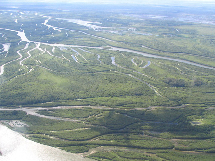
Researchers said Prairie potholes – thousands of tiny wetland lakes formed by glaciers – around the Saint Denis National Wildlife Area and Redberry Lake, and the North Saskatchewan River near the Petrofka Bridge, offer the ideal locations to study and test AirSWOT.
READ MORE: University team sends first Alberta-made satellite into space: ‘It was perfect’
AirSWOT is an experimental radar for NASA’s Surface Water and Ocean Topography satellite mission that is scheduled to launch in 2021.
The flights will play a key role in NASA’s Arctic-Boreal Vulnerability Experiment (ABoVE), which is flying numerous remote sensing technologies over Canada and Alaska this summer.
The University of Saskatchewan is part of the team taking part in the mapping project.
“This project will have drastic implications on the way we monitor, observe, and predict the hydrology of this planet,” Al Pietroniro, the adjunct professor at the university’s Centre for Hydrology and the director of Environment Canada’s National Hydrological Services, said in a release.
“We are looking at a focal point for Canada in hydrology research related to SWOT right here in Saskatchewan.”
READ MORE: University of Saskatchewan tests Canada’s first PhytoPET imaging system
The research team is using the Saskatchewan flights to create accurate calibrations using on-ground measurements in partnership with the Jet Propulsion Laboratory.
- Enter at your own risk: New home security camera aims paintballs at intruders
- Boston Dynamics unveils ‘creepy’ new fully electric humanoid robot
- Nova Scotia scraps spring bear hunt idea, public ‘very divided’ on issue
- Ontario First Nation calls for chemical plant to be shut down amid ‘dangerously high’ benzene levels
The measurements will then be used to determine both the river’s elevation and slope of the bank, ultimately leading to a calibration for the satellite.
“By determining the accurate height and slope of the river, we can try and estimate the velocity and flow in the river reach,” Pietroniro said.
“Although not as accurate as in-stream measurements, it will supplement our existing networks.”
READ MORE: Satellite launched into orbit a ‘quantum leap’ in weather forecasting
Researchers said the technology will be able to provide valuable insights in understanding changes to water levels in wetlands, river flow, and permafrost studies.
Eventually it will allow researchers to monitor droughts and floods, changes in reservoir storage, manage river commerce for shipping, and allow communities to plan future flow conditions – even when upstream water sources are located in other countries.
Comments