

London is expecting a double-digit warm up this long weekend, but the forecast will get worse before it gets better.

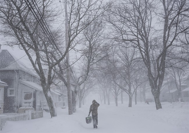
Environment Canada is continuing a snow squall warning for London, Parkhill, Strathroy, and Komoka, along with eastern and western Middlesex County where upwards of 10 centimetres of snow could fall by Thursday afternoon.
The city received seven to eight centimetres of fluffy, lake effect snow overnight and bands of heavy squalls locked into the region Thursday morning extending from north of Goderich, all the way to London.

Get daily National news
The worst of the squalls are north of the city, but Environment Canada meteorologist Weiqing Zhang said drivers across the London area can expect reduced visibility at times.
“We expect the snow squalls to keep going until late this morning, with an additional 10 centimetres of snow possible,” said Zhang. “London might not get as much as areas north of London. By late this morning, the squalls should taper off.”
Officials reported shortly after 6 a.m. that all school buses are starting on schedule Thursday.


Some lingering afternoon flurries could add another two centimetres to the total accumulation.
By tomorrow, warmer temperatures are expected for the region. Sunshine with a daytime high of 3 C is expected for Friday.
Zhang said it only gets better from there.
“It looks like Saturday will be the warmest day,” she said. “The average temperature could reach at least 10 C.”
The forecast is also predicting daytime highs near 10 C for Sunday and Family Day Monday.
Comments
Comments closed.
Due to the sensitive and/or legal subject matter of some of the content on globalnews.ca, we reserve the ability to disable comments from time to time.
Please see our Commenting Policy for more.