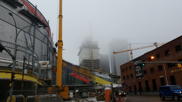
EDMONTON – After a soggy Sunday night, complete with wet snow and rain in the Capital Region, foggy conditions remained through much of the day. The fog stretched from Whitecourt to Medicine Hat overnight, and fog advisories from Environment Canada remained in place until late Monday morning.

With more flurries or freezing rain in the forecast for Monday night, there is potential for a foggy repeat in central and eastern parts of Alberta Monday night and Tuesday morning.
“There’s currently a lot of low level moisture in the region,” Global Edmonton’s Chief Meteorologist Jesse Beyer explained, noting the continued precipitation will add to the humidity.
“That, combined with the remaining snow pack that’s keeping surface temperatures cool, will lead to the fog.”

Fog reduced visibility at the Edmonton International Airport on Monday morning.
Temperatures in Edmonton Monday hovered right around the freezing mark for most of the day, and are expected to be slightly cooler overnight.
In terms of the freezing rain or snow expected for Monday night, “temperatures in the mid layers of the atmosphere will determine the precipitation type,” Beyer said.
“Surface temperatures will likely be below 0°C, especially on our ring roads and surrounding highways,” Beyer explained.
Even if the precipitation falls as a rain, there’s still a risk of slick surface conditions.
“With roads typically being the first to cool, there’s a chance we could see even mixed precipitation freeze on contact.”
“The combination of icy roads and reduced visibility due to fog and rain/snow could make Tuesday morning’s commute slow going.”
Conditions look to stabilize moving forward through the work week.
“After the system moves off towards the south east, the sky will clear and warmer air will stream in,” Beyer said.
“Any icing or fresh snow won’t stand a chance with surface temps returning to the 5-10°C range for the second half of the week.”
- 2021 heat dome fuelled by climate change, intensified wildfire risk: study
- B.C. introduces legislation recognizing Haida Gwaii Indigenous title
- Whale experts confident B.C. orca calf will survive, find family if rescue plan succeeds
- Plastic production cap still contentious as Ottawa set to host treaty talks


Comments