
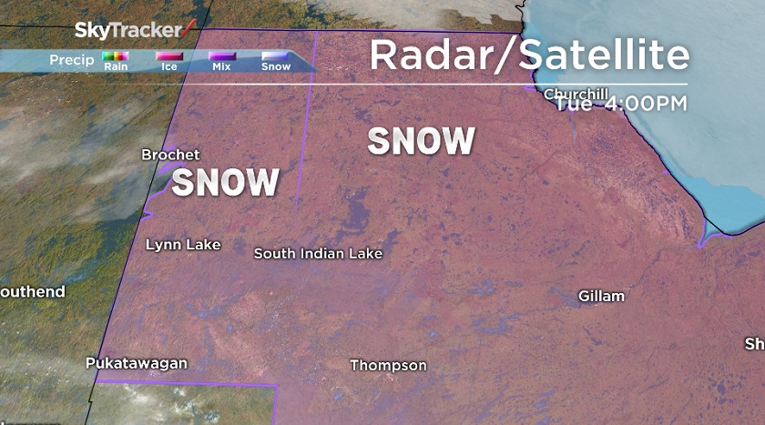
WINNIPEG — Winter isn’t quite done with northern Manitoba. A significant storm is expected to hit much of northern Manitoba Wednesday night and into Thursday morning according to Environment Canada.

15-20 cm’s of heavy, wet snow is expected to fall near Lynn Lake north of Thompson and Gillam but south of Churchill and Tadoule Lake. 15-25 mm’s of freezing rain and ice pellets are expected with the worst falling around Thompson and northeastward toward Gillam.
When the storm hits, travel is to be avoided if possible. Roadways could become slippery and icy creating dangerous driving conditions.
The system is currently over southern Alberta and is expected to intensify as it moves north and enters Manitoba. Environment Canada warns the system is still developing and that there is some uncertainty of where the worst of the storm will hit.


Full list of affected areas:
- Brochet, Manitoba
- Tadoule Lake, Manitoba
- Lynn Lake – Leaf Rapids – Pukatawagan, Manitoba
- Thompson – Nelson House – Split lake, Manitoba
- Churchill, Manitoba
- York, Manitoba
- Gillam, Manitoba
- Shamattawa, Manitoba
More to come
- Life in the forest: How Stanley Park’s longest resident survived a changing landscape
- Bird flu risk to humans an ‘enormous concern,’ WHO says. Here’s what to know
- Mental health support still lacking 4 years after mass shooting: Nova Scotia mayor
- Buzz kill? Gen Z less interested in coffee than older Canadians, survey shows
Comments