
Weather Update: Monday July 14th 3:45pm

Record highs were broken across BC yesterday including a few communities in our broadcast area.
Kelowna, Vernon and Osoyoos were the three communities in the Okanagan that broke records.

Other areas that were hot on Sunday but didn’t quite break records included:
Summerland: 36.9C
Revelstoke: 36.1C
Penticton: 36.0C
Salmon Arm: 35.5C
Nakusp: 35.5C
Today an upper trough is moving across our region, and as you can see on the radar, isolated showers are currently falling across parts of the Southern Interior.


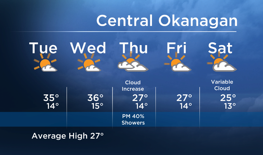
The upper ridge rebounds tomorrow for a couple more days, and temperatures will return back up to the mid 30’s for most areas Tuesday and Wednesday.
However as the next upper trough moves in Thursday evening, the chance of showers and cooler temperatures will return later in the week.
Tuesdays High: 30 to 37C
~Wesla/Duane
- What is a halal mortgage? How interest-free home financing works in Canada
- Capital gains changes are ‘really fair,’ Freeland says, as doctors cry foul
- Ontario doctors offer solutions to help address shortage of family physicians
- Budget 2024 failed to spark ‘political reboot’ for Liberals, polling suggests
Comments