
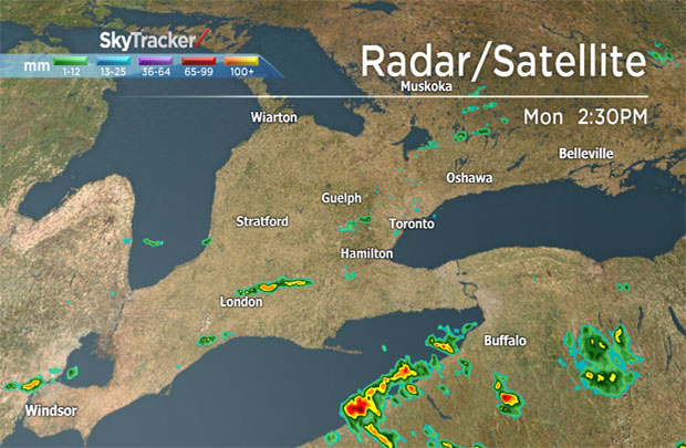
TORONTO – More thunderstorms are making their way across southern Ontario, following a night of storms that brought heavy rain and lightning.

At 2:10 p.m. on Monday Environment Canada issued a severe thunderstorm warning for:
Windsor – Leamington – Essex County
The warning is in effect until 5:06 p.m.
An earlier warning for the London and Strathroy area was dropped.
Environment Canada also issued a severe thunderstorm watch just before 1 p.m. for:
- Hamilton
- Dunnville – Caledonia – Haldimand
- Rodney – Shedden – Western Elgin County
- St. Thomas – Aylmer – Eastern Elgin County
- Niagara Falls – Welland – Southern Niagara Region
- St. Catharines – Grimsby – Northern Niagara Region
- Sarnia – Petrolia – Western Lambton County
- Watford – Pinery Park – Eastern Lambton County
- Simcoe – Delhi – Norfolk
- Chatham-Kent – Rondeau Park
- Windsor – Leamington – Essex County
- London – Parkhill – Eastern Middlesex County
- Strathroy – Komoka – Western Middlesex County.
Thunderstorms are possible Monday afternoon into the early evening and may produce torrential downpours with local amounts of 50 mm and wind gusts of 90 km/h.
Overnight, some areas of southwestern Ontario received 40 mm of rain or more. In Wellesley, the Grand River Conservation Authority reported 78.6 mm of rain.
READ MORE: WATCH – CN Tower struck by lightning during overnight storm


A watch is issued when conditions are favourable for severe weather. A warning is when hazardous weather is imminent or occurring.
To get real-time weather for your area, download the Global News Skytracker weather app.
BELOW: Will the afternoon thundershowers in Southern Ontario effect the commute in the GTHA?
- Canadian man dies during Texas Ironman event. His widow wants answers as to why
- On the ‘frontline’: Toronto-area residents hiring security firms to fight auto theft
- Honda’s $15B Ontario EV plant marks ‘historic day,’ Trudeau says
- Canadians more likely to eat food past best-before date. What are the risks?
Comments