
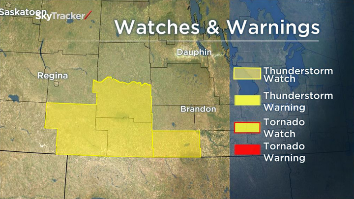
WINNIPEG – Parts of southwestern Manitoba could get severe thunderstorms that might drop 40 to 70 millimetres of rain in just a couple of hours Wednesday, Environment Canada says.

The weather agency issued a severe thunderstorm watch about a weather system expected to move out of Montana and North Dakota into the Melita, Boissevain and Turtle Mountain Provincial Park area Wednesday during the late afternoon and early evening.
“Conditions are favourable for the development of very dangerous thunderstorms that may be capable of producing strong wind gusts, large hail and flooding rain,” Environment Canada said in an alert.
The system is expected to move slowly and the thunderstorms’ intensity will fluctuate, causing highly varied rainfall amounts across the area, Environment Canada said.
“Remember, severe thunderstorms can produce tornadoes. Be prepared for severe weather,” the alert says. “Take cover immediately if threatening weather approaches. Stay indoors when a thunderstorm strikes.”


The storms are expected to push north and eastward into the southern Red River Valley overnight.
Rain isn’t expected in Winnipeg until Thursday. A few clouds and a high of 25 C are predicted for Winnipeg on Wednesday, with thunderstorms beginning early Thursday.
RELATED: SkyTracker weather
- Life in the forest: How Stanley Park’s longest resident survived a changing landscape
- ‘They knew’: Victims of sexual abuse by Ontario youth leader sue Anglican Church
- Carbon rebate labelling in bank deposits fuelling confusion, minister says
- Buzz kill? Gen Z less interested in coffee than older Canadians, survey shows
Comments