
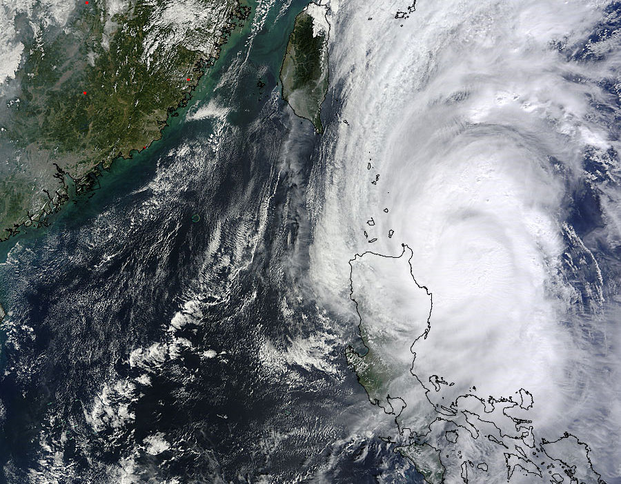
TORONTO – Residents in the northern Philippines were lashed with wind and rain on Friday as Typhoon Krosa made landfall.

As of Friday afternoon (Eastern Standard Time) the typhoon was producing sustained winds of near 160 km/h with gusts of up to 195 km/h. On the Saffir-Simpson Scale, which the National Hurricane Center in Miami uses to measure hurricane strength, Krosa would be a Category 2 hurricane. The scale ranges from Category 1 to Category 5.
Krosa is about 448 km southeast of Hong Kong and has moved west-northwestward at 17 km/h over the past six hours. Maximum wave height has been recorded at 30 feet. The eye of the storm is about 35 km wide.
The storm is forecast to pass over the South China Sea where warmer waters near 30 C may serve to strengthen it. It will continue to track west-nortwestward while intensifying and then turn southwestward by last Saturday.

Comments