

The Antarctic is melting, new satellite photos released by NASA show.

Before and after photos of Eagle Island ice caps were taken by Landsat Science’s Operational Land Imager during a heatwave between Feb. 4 and Feb. 13. The NASA Earth Observatory said the photos show the heatwave melted 20 per cent of the island’s snow in a matter of nine days.
Mauri Pelto, a glaciologist at Nichols College in Massachusetts, told the NASA Earth Observatory that consistently high temperatures have led to the melting and have become more frequent since the start of the century.
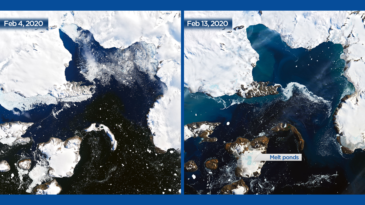
“I haven’t seen melt ponds develop this quickly in Antarctica,” he said. “You see these kinds of melt events in Alaska and Greenland, but not usually in Antarctica.”
The World Meteorological Organization said Antarctica set a new record temperature of 18.4 C on Feb. 6, beating out the former record of 17.5 C in March of 2015.
According to the WMO, most of the ice loss can be attributed to melting ice shelves and relatively warm ocean water, especially in west Antarctica.
The WMO said the Antarctic Peninsula is among the fastest-warming regions of the planet, melting rapidly at almost 3 C over the last 50 years.


They said Antarctica’s ice sheets contain enough water to raise global sea levels by nearly 60 metres.
The observatory said in a Friday report that a combination of meteorological elements was behind February’s warm temperatures.
They said the air masses that typically shield the Antarctic Peninsula were in a weakened state and allowed warm air to cross the Southern Ocean and reach the western ice sheets.
“The drier air means fewer low-lying clouds and potentially more direct sunlight east of the mountain range,” the WMO said in their report.
“This warm, dry air travels downslope on the other side of the mountains, bringing blasts of heat to parts of the peninsula.”
The WMO said the February heatwave was the third major melting event of the 2019-20 summer, following warm spells in Nov. 2019 and Jan. 2020.
“If you think about this one event in February, it isn’t that significant,” said Pelto.
“It’s more significant that these events are coming more frequently.“
Comments