
A snowfall warning has been issued for the Trans-Canada Highway in southeastern B.C.

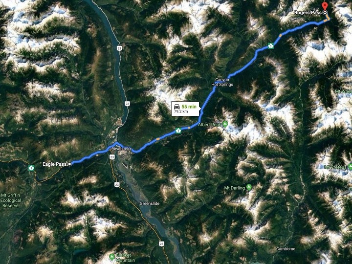
The warning encompasses the stretch from Eagle Pass, which is just west of Revelstoke, to Rogers Pass — a distance of approximately 80 kilometres.
Environment Canada is forecasting 15 to 25 centimetres of snow for the area.

“Snow at times heavy will begin this evening, as a frontal system moves into the Columbia region,” said the national weather service.
“Heavy snow will continue into Friday morning with up to 25 cm possible by Friday afternoon.”


Eagle Pass has an elevation of 550 metres (1,804 feet) while Rogers Pass has an elevation of 1,327 metres (4,353 feet).
Revelstoke, meanwhile, has an elevation of 480 metres (1,570 feet).

Comparatively, Kelowna has an elevation of of approximately 345 metres (1,131 feet) while Calgary’s elevation is 1,045 metres (3,428 feet).
The three tallest mountain passes in B.C. are, in order:
- Kootenay Pass (1,774 metres; 5,820 feet) along Highway 3.
- Pennask Summit (1,728 metres; 5,669 feet) along the Okanagan Connector.
- Kicking Horse Pass (1,643 metres; 5,390 feet) in Yoho National Park.
Comments