
WINNIPEG – Overcast conditions dominated Tuesday with light rain showers and cool winds which are causing a drop to afternoon temperatures.

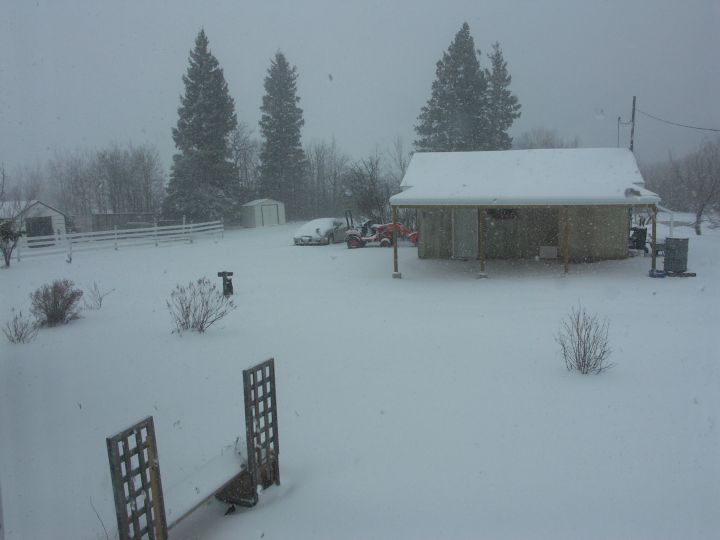
A late spring storm moved into the region overnight and by morning, had wreaked havoc on communities across west-central Manitoba. McCreary and Dauphin woke up to a fresh layer of snow and a scene that looked more like November than almost May. As of 10am, unofficial reports from local weather spotters put snow totals as high as 15 to 20 centimetres. With snow continuing to fall, official totals won’t be calculated until this system moves out and flurries taper off completely.
Wind was also a factor in Tuesday’s weather story. Strong northerly winds have pulled cool air southward, creating a drop to afternoon temperatures below the freezing mark. Those winds are also reducing visibility in blowing snow over open areas.


Snowfall warnings remain in effect for central Manitoba with an additional 5-10 centimetres expected through the overnight hours.
So when will we see the sun?
Forecast conditions are showing this system lingering throughout the day Wednesday with another 3-5 centimetres expected across the southwest and light flurries for Winnipeg and surrounding communities. By Thursday morning, you can be reaching for those sunglasses again with a recovery to our normal temperatures by the weekend.
Comments