
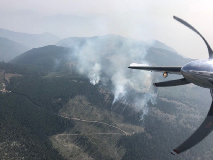
Six new wildfires are burning in the South Okanagan and Similkameen, with most being in remote locations.

The largest of the six is a 100-hectare wildfire burning approximately 35 kilometres west of Keremeos at a location called Cool Creek. There are three smaller fires near that blaze.
Those three are the Etches Creek wildfire, estimated 0.01 hectares and eight km to the east of Cool Creek; the Willis Creek wildfire, estimated at 60 hectares and eight km to the west of Cool Creek; and the Willis Smith wildfire, estimated at 14.5 hectares and six km to the north of Cool Creek.
The remaining wildfires are burning north of Keremeos and northwest of Hedley.
The Olalla Forest Service Road fire is estimated at 50 hectares and is located at the 19-kilometre mark of the road, approximately 10 kilometres north of Keremeos.
The Stemwinder fire is small at 0.20 hectares and is located 6.5 kilometres north of Hedley.
The Regional District of the Okanagan-Similkameen (RDOS) said the Olalla Forest Service Road fire is thought to have been sparked by lightning. It adds the fire isn’t a threat to properties or structures in Olalla or the Lower Similkameen Indian Band.
Regarding the ongoing Snowy Mountain wildfire, the RDOS said plans are underway for feeding, trail clearing and the safe egress of cattle from Snowy Mountain in the Snowy Protected area. This process is expected to continue over the next few days.
As for upcoming weather patterns, B.C. Wildfire Service information officer Marla Catherall said “there’s a 20 per cent chance of dry lightning in the Kamloops and Vernon zone today, and there’s a 20 per cent of chance of lightning in the North Thompson and Monashees tomorrow. Temperatures will get slightly cooler tomorrow and until Sunday, just by a couple of degrees each day.”
Below is a list of notable fires in the Okanagan and Similkameen
OKANAGAN
Mount Gottfriedsen
- Location: Pennask Mountain, near Highway 97C, 24 kilometres west of West Kelowna.
- Size: 730 hectares.
- Cause: Lightning.
- Status: Active. Eighty-one personnel on site with eight pieces of heavy equipment. The fire received some precipitation overnight on August 11th. This assisted in firefighting efforts by decreasing fire intensity and fire behaviour. Since then, crews have successfully constructed control lines around the perimeter of the fire and are establishing hose lays to assist in mopping up operations.
- BCWS notes: “Construction of all control lines are complete. Crews patrolled and extinguished hotspots. Crews will continue to mop up and extend hose lay around the fire. Heavy equipment will continue working to expand access routes and danger tree assessment will continue throughout the day.”
Harris Creek Forest Service Road
- Location: 16 kilometres southeast of Lumby.
- Size: 508 hectares.
- Cause: Lightning.
- Status: Active, classified as out of control. Twenty-four personnel on site along with eight pieces of heavy equipment and five helicopters.
- BCWS notes: “Crews successfully carried out hand ignition yesterday to strengthen containment lines. Crews continue containment on west flank, are reinforcing the containment line around south flank, and are completing machine guard towards east drainage. They also plan to conduct hand ignition to tie together guards on east side. A containment line has been completed around a large portion of the fire. However, further work is required in several areas.”
Sugar Mountain
- Location: Four kilometres east of Sugar Lake.
- Size: 332 hectares.
- Cause: Under investigation.
- Status: Active, classified as out of control. Ten personnel on site, along with five pieces of heavy equipment and five helicopters.
- BCWS notes: “Currently, we are not expecting any significant fire growth because winds are forecast to be fairly light in this region. We are also seeing high relative humidity values overnight, which will help to temper fire behaviour. Danger trees are a hazard throughout this complex. Many of the fires are burning in high elevation with steep and rocky terrain. Anticipated challenges include possible new fire starts emerging from holdover lightning strikes, the potential for higher fire behaviour this week and the potential for fire growth. The smoky conditions have been challenging our operations but increased visibility today will allow for increased fire suppression activities as well as the opportunity to fly rotary aircraft.”
Mabel Creek
- Location: Six kilometres east of Mabel Lake.
- Size: 1,861 hectares.
- Cause: Under investigation; suspected lightning caused.
- Status: Active, classified as out of control. Twenty-three personnel on site with five helicopters and eight pieces of heavy equipment. An area restriction order is in place for crown land in the vicinity of Mabel Lake.
- BCWS notes: “This fire has grown to the west past Mabel Creek and has joined with several smaller fires.”
Juliet Creek
- Location: 47 kilometres southwest of Merritt.
- Size: 868 hectares.
- Cause: Lightning.
- Status: Active. Sixty-eight personnel on site along with 13 pieces of heavy equipment. Air support available as needed.
- BCWS notes: “Crews made good progress establishing control lines up to Michael Lake. Danger tree assessment and falling has begun along the roads. Small scale planned hand ignitions went extremely well yesterday. Crews will work to tie a control line at the head of the fire in to a scree slope. They will also work to identify anchor points along the eastern flank and line it with hose.”
SIMILKAMEEN
Snowy Mountain
- Location: 14 kilometres south of Keremeos.
- Size: 13,359 hectares.
- Cause: Lightning.
- Status: Active; classified as being held. Eleven personnel on site along with two helicopters. Additional air support available as needed. Crews will continue to work on the fire patrolling and mopping up.
- BCWS notes: “The B.C. Wildfire Service incident management team assigned to the Snowy Mountain fire is working collaboratively with the U.S. Forest Service, U.S. Bureau of Land Management, and the Washington State Department of Natural Resources given the fire’s proximity to the border. The steep terrain is inoperable in some areas, and poses a safety risk to firefighting personnel. Crews are being strategically placed where it is safe and where suppression objectives can be met.”
Comments