

It may seem like fall just rolled in, but Canadians should be getting their shovels and parkas out soon as winter is soon on its way (if it hasn’t yet arrived). Here is a look at what Canadians can expect for the upcoming winter months.

Although some parts of Canada have already been hit with an early blast of snow, the eastern half of the country is experiencing one of the warmest fall seasons on record.
Residents of southern Quebec and Ontario have actually experienced more dry, sunny days over the past two months than over the course of the entire summer.
Meanwhile, the back and forth pattern in the west has brought early season snow followed by record warmth, winds, brush fires then right back to cold and snow. Enough wild weather swings to give even hardy Prairie residents whiplash.
So is this a sign of the winter season ahead? Let’s take a look.
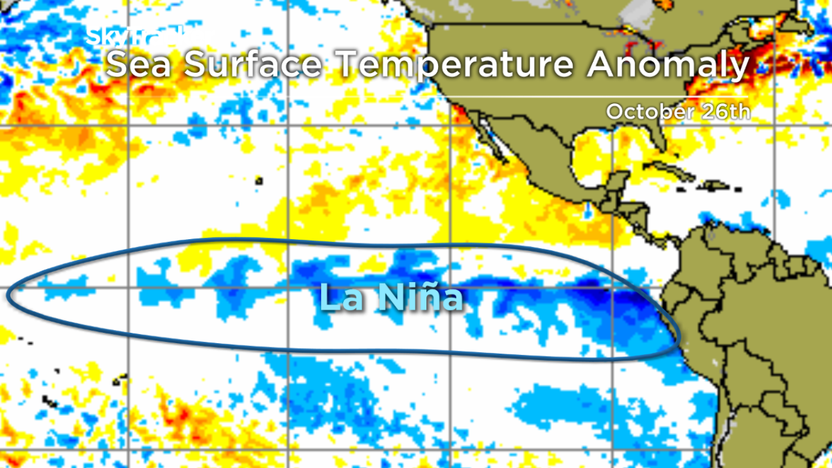
La Nina
The water temperatures in the equator region of the Pacific have been cooler than normal through the fall and computer models are predicting a weak La Nina will remain in place this winter.
La Nina is the less famous sister of her attention-grabbing sibling El Nino but can still impact weather patterns around the world. The jet stream is typically weaker, loopy and moves around a lot which makes predicting a “typical La Nina winter” very difficult.
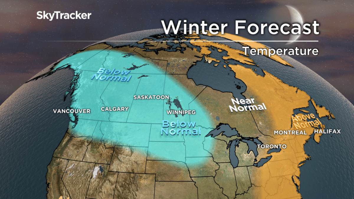
In La Nina years, colder than normal air is more likely across western Canada than in the east but lots of snow occurs around the Great Lakes and in BC.
Our winter forecast
B.C. and Alberta
The cold will be king this winter across the western Prairies but some of this will spill across the Rockies into coastal B.C.
WATCH: First snow of the season for many areas of B.C.

In La Nina years the jet stream is normally weaker and oscillates more than usual meaning Arctic air won’t easily get routed out as above normal precipitation falls overhead. This will lead to a snowy winter from Whitehorse to Vancouver and Calgary and everywhere in between.
READ MORE: Massive snowfall in Jasper National Park leaves Marmot Basin a winter wonderland
It also should be another great ski season for the mountains in the west with more light powder days thanks to the colder temperatures.
Saskatchewan, Manitoba, northwestern Ontario
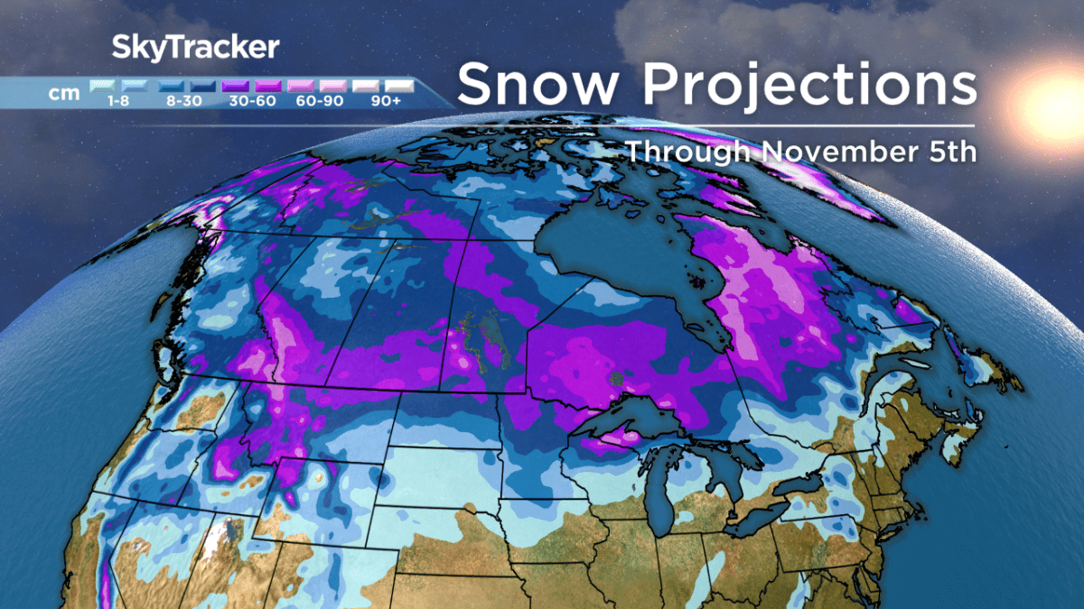
Get ready for an early onslaught of winter this year. Arctic air is already building across northern Canada and will be sliding south with increased frequency through November.
At the same time, frequent storms will tap into this cold and deliver significant early season snow. Once the snowpack is in place, watch out because it could become cold fast leading up to Christmas this year.


I do think the winter extremes will ease for a time in January before reloading in February but there is a concern that winter will end up colder than what we’re forecasting especially if blocking occurs over the Arctic. Snowfall will be heavy early in the season with a higher frequency of weak clippers later in the winter.

Southern Ontario and Quebec
The similarities between the fall of 2007 and the extremely mild fall of 2017 are striking. Both had developing La Ninas and the winter that followed in ‘07 was very snowy across Quebec and Ontario.
We are looking at a similarly active storm track this year which will lead to early season snow and frequent bouts of winter weather lasting late into March. With the cold and snow building in the west, it’s just a matter of time before it spills into the eastern half of Canada.
December will likely be a very snowy month which increases the odds of a white Christmas this year. There is good news for those less fond of winter.
Temperatures are forecast to be slightly above normal this season with lots of back and forth especially in January.
Note: There is higher than normal uncertainty when it comes to the temperature forecast for this region.
Atlantic Canada
With a stubborn eastern ridge holding for at least the first part of winter, temperatures will remain mild with more rain than snow.
The favoured La Nina storm track is to the west which puts the Maritimes on the mild and wet side of most storms.
We are also expecting frequent blocking over Greenland and the Arctic which could eventually push frigid air in, especially in February and March. Overall, this winter appears less snowy and milder than past years.
Comments