

Storms sliding through an area with large lightning-sparked fires now burning within 1 kilometre of communities as strong winds kick up.

Special Weather Statement for Saskatoon
Environment Canada has issued a special weather statement for Saskatoon, Prince Albert, North Battleford and many other parts of Saskatchewan for elevated pollution levels from smoke.
Numerous forest fires in northern Saskatchewan continue to result in reduced visibility in smoke and poor air quality in that area today.
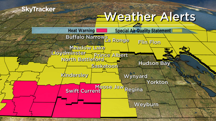
Widespread smoke will gradually work its way eastward behind a trough which moved into western Saskatchewan on Thursday morning.
Hazy or smokey conditions will likely return on Friday as westerly winds redevelop and once again spread smoke plumes eastwards.
For the latest weather alerts download the Global News Skytracker weather app for iPhone, iPad or Android.
Wildfire Update/Fire Bans
Thunderstorms have sparked up in the portion of eastern Saskatchewan already filled with numerous lightning-sparked fires.
Thirty-four fires are burning in Saskatchewan, three of which are uncontained and burning near Pelican Narrows .
Fires are now within one kilometre of the communities of Jan Lake and Birch Portage, but no structures have been lost as of Thursday morning.
Fire is also currently threatening power lines that run parallel to Highway 135.
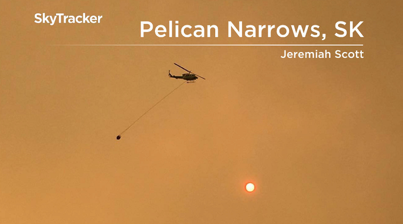
Thousands of people have been placed under a general evacuation in Pelican Narrows, a community of nearly 3,000 people, where a state of emergency has been issued.
READ MORE: Northern Saskatchewan wildfires force more Pelican Narrows residents from homes
States of emergency have now been issued for Sandy Bay, Pelican Narrows and Jan Lake.
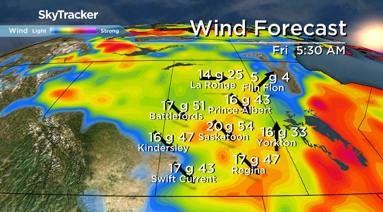
Winds will transition to the northwest into Friday with gusts upwards of 50 km/h at times and are projected to remain breezy until next week.
A fire ban has been issued for the southern two-thirds of Saskatchewan including all crown land and provincial parks south of the Churchill River, Prince Albert National Park as well as the city of North Battleford, parts of Prince Albert and numerous other communities.
Open fires are prohibited and the Government of Saskatchewan says some roads and campgrounds may be closed due to the extreme fire hazard.
Saskatoon Forecast
Today
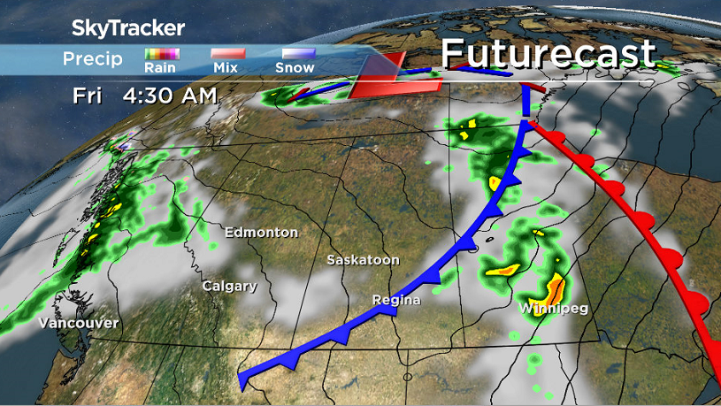
A trough of low pressure swinging through the province has brought back the clouds, scattered showers and thunderstorms across the region to end off the month.
This morning Saskatoon saw the warmest overnight low ever recorded in the city when we dipped back to 19 degrees, before warming up to 27 degrees by noon.
Remaining heat from the upper ridge are keeping condition hot through the rest of the final day of August, with temperatures climbing into the 30s and a chance of showers and risk of a thunderstorm during the afternoon.
Tonight
Clouds will clear out tonight as we slide back to a much cooler low around 12 degrees.
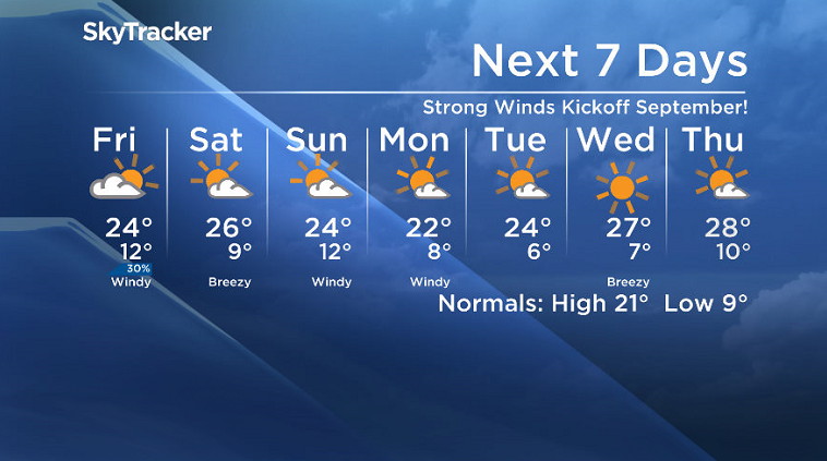
Friday
Some sunshine should start September before clouds roll back in during the day with a chance of showers later on.


A cold front sweeping through will kick up breezy northwesterly winds during the day up to 30 km/h with gusts in excess of 50 km/h as we struggle to get into the mid 20s.
Labour Day Long Weekend
The September long weekend isn’t shaping up to be too shabby with clouds in and out through the weekend and daytime highs in the mid 20s Saturday and Sunday.
A bit more sunshine should slip through on Labour Day Monday after a cold front passes by, dipping daytime highs back into the low 20s.
Work Week Outlook
It’ll be a mostly sunny work week with daytime highs recovering back into the mid 20s before pushing up a bit further later in the week.
Laura Iron took this Your Saskatchewan photo at Canoe Lake:

Saskatoon weather outlook is your source for Saskatoon’s most accurate forecast and is your one stop shop for all things weather for central and northern Saskatchewan with comprehensive, in depth analysis that you can only find here.
Comments