

Smoke, deteriorated air quality and storms make their return ahead.

Saskatoon Forecast
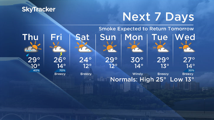
Wednesday
It was a wild Tuesday evening north of Saskatoon with severe warned thunderstorms that strengthened as they moved from north of the Battlefords through Hepburn and into the Hague area.
Pea-sized hail was reported as well as strong wind gusts that downed trees in some areas.
A few fog patches started the morning as we dipped back to 6 degrees before mostly sunny skies kicked in and we warmed up into the high teens before noon.
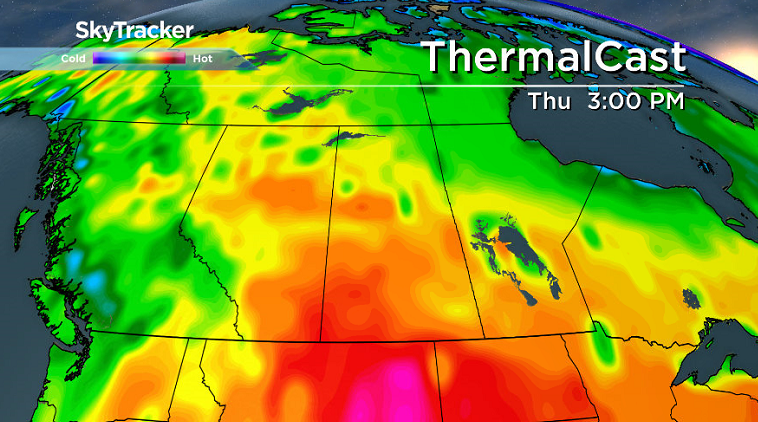
High pressure dominated the rest of the day with sunny skies and a daytime high in the mid 20s.
Thursday
After a sunny start to the day, a push of air from the Pacific, along with a low pressure system developing in Alberta, will build in the clouds during the day with a late afternoon and evening chance of showers or thunderstorms.
The flow aloft is expected to funnel in smoke from B.C. wildfires into Thursday, which will trap some of the sun’s energy, so depending how much moves in, we may only hit a high of 29 degrees.
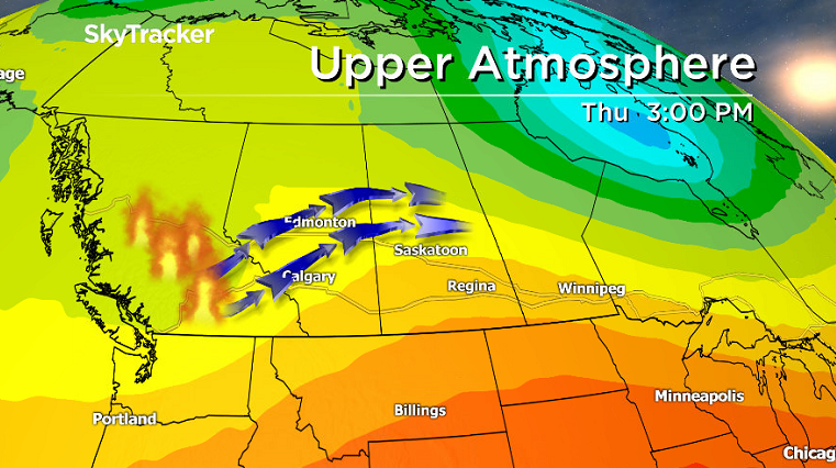
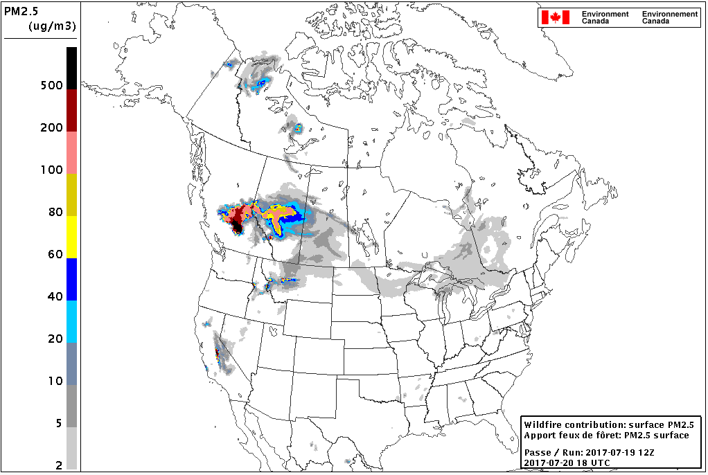
If the smoke is less dense during the day, we could climb up to an afternoon high in the low 30s.
Friday
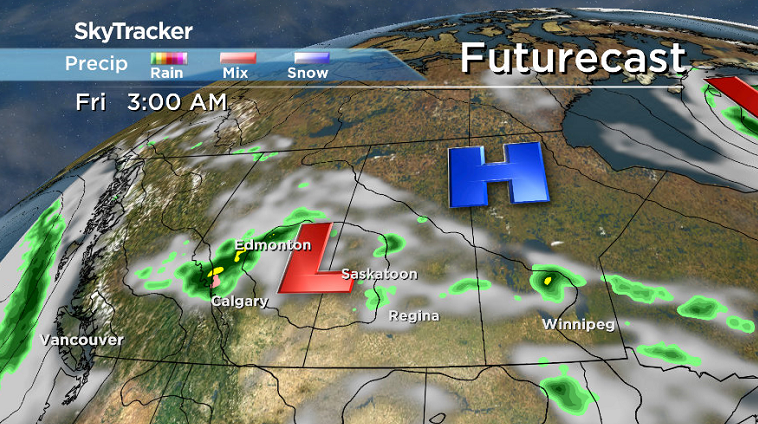
A risk of thunderstorms and rain moves in for Friday as that low pressure system swings into Saskatchewan.


The best chance of precipitation and storms is during the morning and later in the afternoon and into the evening as we rise up to a daytime high in the mid 20s.
Weekend Outlook
Cooler air will slip in behind the system on Saturday with some lingering cloud that should clear out later on as we climb to a high in the mid 20s before a building upper ridge returns us into the sun and a daytime high in the upper 20s on Sunday.
This Your Saskatchewan photo was taken at Last Mountain Lake by Linda Phillips:

Saskatoon weather outlook is your source for Saskatoon’s most accurate forecast and is your one stop shop for all things weather for central and northern Saskatchewan with comprehensive, in depth analysis that you can only find here.
Comments