

From bathing in the streets of Saskatoon to extreme fire danger in days!

Saskatoon Forecast
Friday
We’ve gone from bathing in the streets of Saskatoon on Monday to an extreme fire danger due to bone dry conditions, in just a few days!
WATCH: ‘1-in-25 year storm’ slams Saskatoon with flooding, hail and major power outages
Saskatoon started out the day around 14 degrees with partly to mostly sunny skies through the morning as we warmed up to the low 20s before noon with a northwest wind around 40 gusting to 53 km/h.
That northwest wind will continue to kick in the cool air behind the system that brought in severe storms to parts of the north, with a daytime high only reaching 27 degrees under partly to mostly sunny skies.
Friday Night
Clear skies will return Friday night as a surface high slides by and we cool back to 13 degrees.
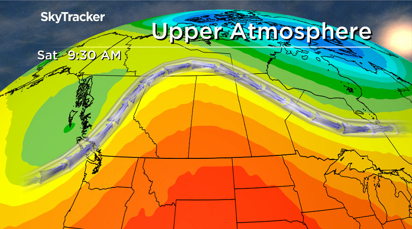
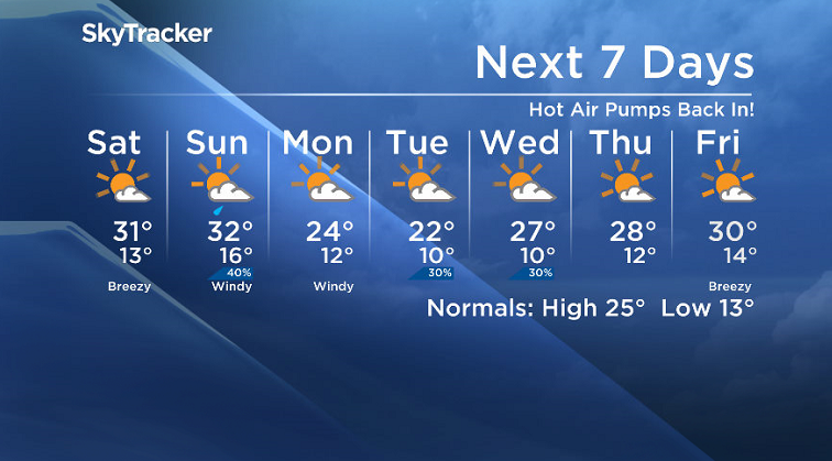
Saturday
It’ll be a hot and dry start to the weekend with an extreme fire danger moving in as we sit under sunny skies in the morning with a few more clouds moving in later on.

Our daytime high should top out around a sweltering 31 degrees as we hit the heart of an upper ridge building in with breezy southeasterly winds during the day.
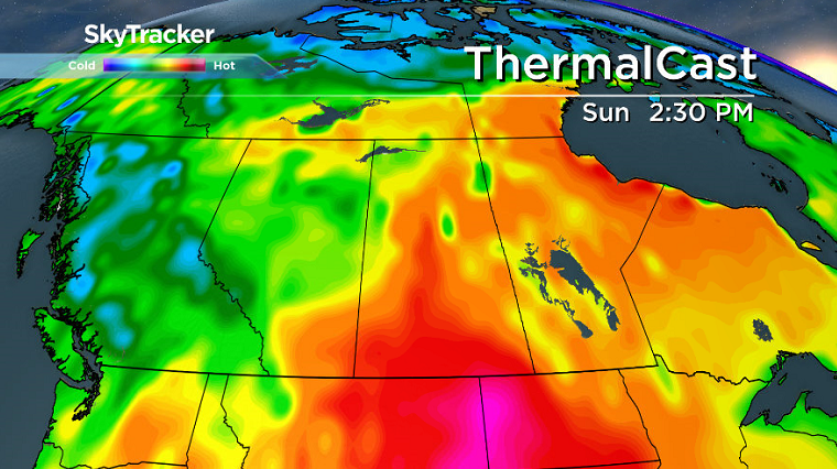
Sunday
A system sliding by in the north will bring a trough through the area early Sunday, bringing with it some showers before we get into some midday sunny breaks and a late day chance of showers or thunderstorms as the associated cold front pushes in.
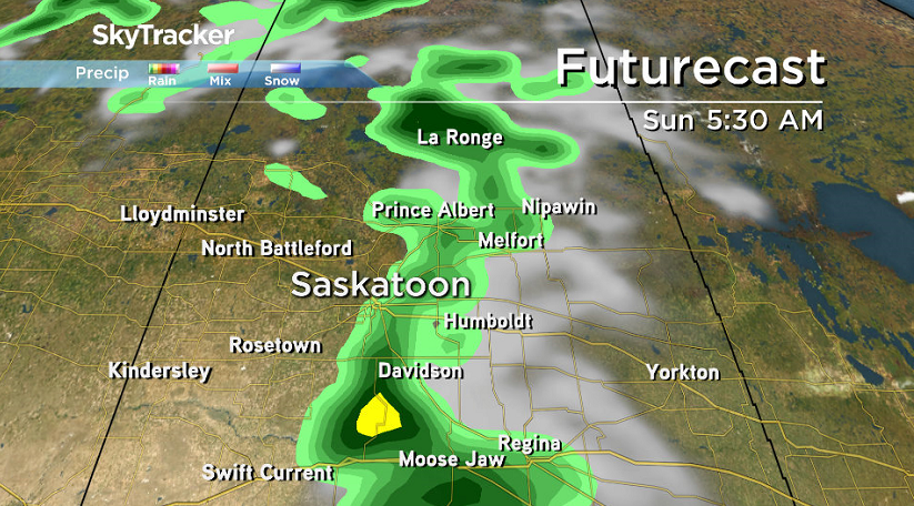
We’ll start out fairly warm with temperatures only dipping back into the upper teens to start the day before warming up into the low 30s in the afternoon with a breezy southwest wind with gusts of 50 to 60 km/h.


Work Week Outlook
A big cold front will push through Monday and drop daytime highs back into the mid 20s on Monday, then the low 20s on Tuesday with a mix of sun and cloud and a slight chance of showers into Tuesday.
Partly to mostly sunny skies will then stick around for the rest of the week with afternoon highs returning back into the upper 20s, possibly even pushing into the low 30s by Friday.
This Your Saskatchewan photo was taken by Heather Anderson in Saskatoon:

Saskatoon weather outlook is your source for Saskatoon’s most accurate forecast and is your one stop shop for all things weather for central and northern Saskatchewan with comprehensive, in depth analysis that you can only find here.
- Canadian man dies during Texas Ironman event. His widow wants answers as to why
- On the ‘frontline’: Toronto-area residents hiring security firms to fight auto theft
- Honda’s $15B Ontario EV plant marks ‘historic day,’ Trudeau says
- Canadians more likely to eat food past best-before date. What are the risks?
Comments