Advertisement

B.C. wildfire map: if the fires burned Canadian cities, they might look like this

Click to play video: 'Wildfire Latest Thursday'
Wildfire Latest Thursday
Thu, Jul 13: Officials aren't liking the weekend forecast - winds are expected to pick up, making the fire fight that much harder across the province. Catherine Urquhart has more – Jul 14, 2017

Wildfires have scorched over 78,000 hectares of British Columbia since they started flaring up this summer.

They have forced thousands of people out of their homes, and placed many more on alert.

Coverage of B.C. wildfires on Globalnews.ca:

Story continues below advertisement

For some, like those who live in the cities, it’s difficult to appreciate the scale of thefires as they happen in rural areas.

CKNW producer John O’Dowd has tried to give a sense of the total area covered by the wildfires in a series of tweets.

They show how much of Vancouver would be singed by a fire that reached almost 80,000 hectares:

That’s downtown, Kitsilano, Shaughnessy, UBC and East Vancouver, all charred — to say nothing of neighbouring communities like Richmond, Burnaby and New Westminster.

O’Dowd made his map using the Google Maps Area Calculator Tool, which lives on the website Daft Logic.

READ MORE: B.C. wildfire photos: images show devastation as fires rage parts of B.C.

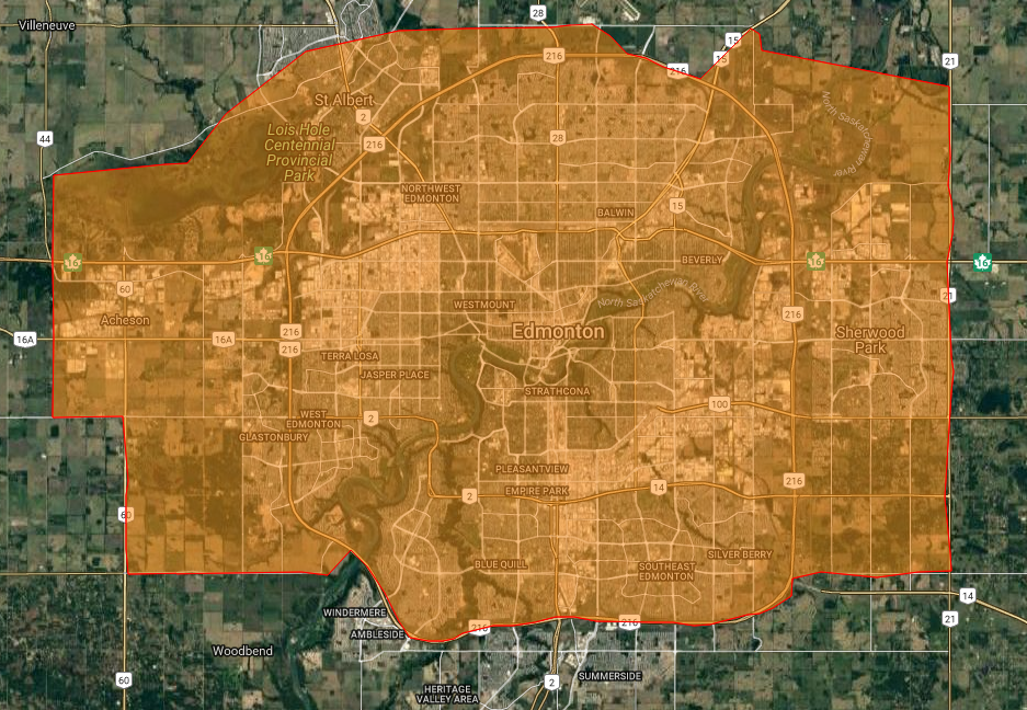
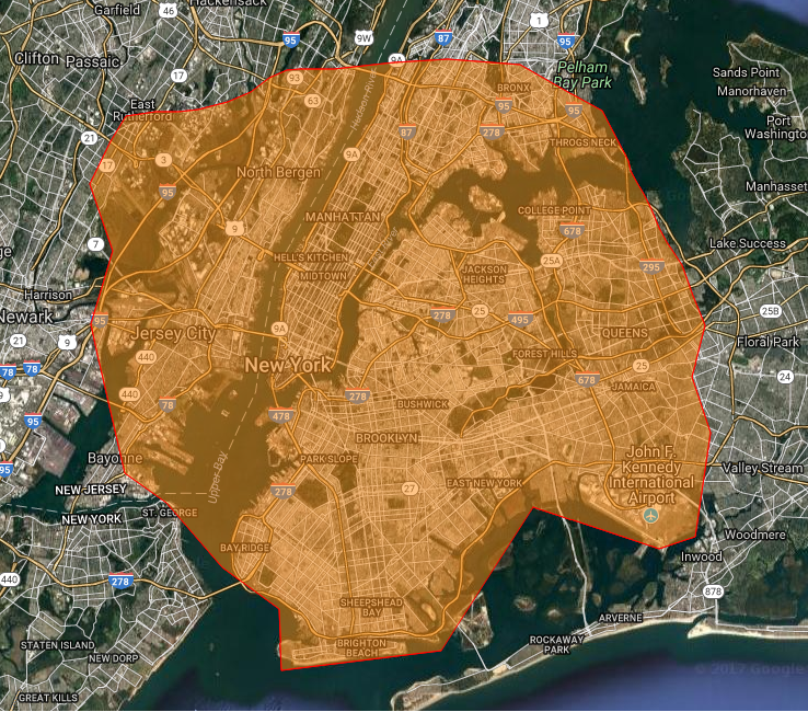
The tool allows users to lay points on Google Maps and draw over cities and regions.

Global News used the tool to estimate what over 78,000 hectares worth of wildfire might look like in six Canadian cities, and three more around the world.

Here’s what those cities would look like if they were covered by wildfires the way B.C. is right now:

Vancouver

This map shows what Vancouver might look like if it were covered in 78,000 hectares of wildfire. Google Maps/DaftLogic

Calgary

What Calgary might look like if it were covered by 78,000 hectares of wildfire. Google Maps/DaftLogic

Edmonton

This map shows the City of Edmonton, if it were covered by 78,000 hectares of wildfire. Google Maps/DaftLogic

Winnipeg

What Winnipeg might look like if it were covered in 78,000 hectares of wildfire. Google Maps/DaftLogic

Toronto

This map shows what Toronto might look like if it were covered by about 78,000 hectares of wildfire. Google Maps/DaftLogic

Montreal

This map shows what Montreal might look like if it were covered in about 78,000 hectares of wildfire. Google Maps/DaftLogic

New York

This map shows what New York might look like if it were covered by over 78,000 hectares of wildfire. Google Maps/DaftLogic

Los Angeles

This map shows what Los Angeles might look like if it were covered in over 78,000 hectares of wildfire. Google Maps/DaftLogic

Paris

This map shows what Paris might look like if it were covered by a wildfire measuring over 78,000 hectares. Google Maps/DaftLogic

Sponsored content

AdChoices