

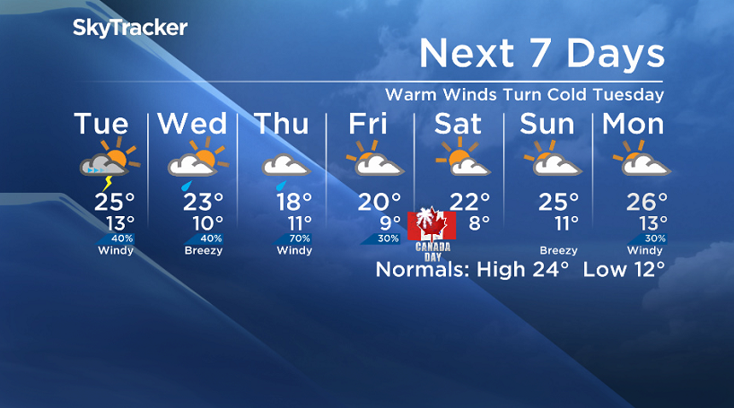
Risk of thunderstorms on Tuesday before rain and wind move back in to round out the month.

Saskatoon Forecast
Today
10 degrees was where Saskatoon started the work week under mostly cloudy skies.
A warm south-southeasterly winds then picked up through the morning to around 30 km/h with gusts upwards of 45 km/h, helping warm us up into the low 20s by noon.
Warm winds will remain brisk this afternoon, helping warm us up into the mid 20s later on with mostly cloudy skies continuing for the rest of the day.
Tonight
Partly to mostly cloudy skies will continue tonight as we slip back down to the low teens by the early morning hours.
Tuesday
Clouds will roll back in on Tuesday as a low pressure system swings in early in the day and brings in a chance of showers and thunderstorms from morning into the early afternoon.
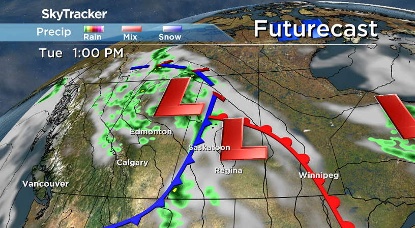
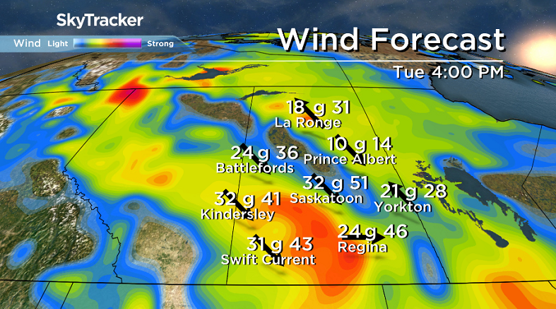
Temperatures will shoot up into the mid 20s by midday before cooling back a few degrees as a cold front sweeps through and kicks up northwesterly winds to 30 km/h with gusts of 50 km/h at times.
Wednesday-Friday
Cooler air will sweep in behind the system, dropping daytime highs from around 23 degrees on Wednesday, back into the high teens on Thursday before gradually rebuilding back into the 20s Friday.
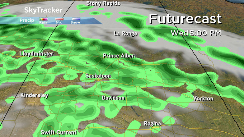
Clouds will roll back in as an upper low swings in on Wednesday bringing in a good chance of rain later in the day, continuing into Thursday before easing into Friday with a mostly cloudy end to the week.


Canada Day 150 Long Weekend Outlook
There is still some significant discrepancy as to what will pan out for the big Canada Day 150 long weekend, however at this point it looks like Saturday will be the sunniest, but also the coolest day with cloud cover and a chance of showers move in for the rest of the long weekend with highs warming into the mid 20s.
We will keep an eye on the situation and bring you the latest, most up-to-date forecast as the weekend in the coming days.
Lori Janzen took this Your Saskatchewan photo in Outlook:

Saskatoon weather outlook is your source for Saskatoon’s most accurate forecast and is your one stop shop for all things weather for central and northern Saskatchewan with comprehensive, in depth analysis that you can only find here.
Comments