

Spring has sprung with a cold front, -20 wind chills and a chance of snow ahead.

Saskatoon Forecast
Today
Much of our snow melted over the past few days as we saw temperatures shoot up into positive double digits over the final weekend of winter.
Spring officially kicked off in Saskatchewan this morning at 4:29 a.m. CT and shortly after it began, a cold front moved through.
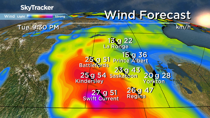
We fell back to -6 with wind chills making it feel like -15 this morning as that front kicked up northwesterly winds at sustained speeds of 40 to 50 km/h with gusts upwards of 60 to 70 km/h.
The clouds associated with the front pushed out allowing skies to clear and bring in some sunshine midday, but winds will make it quite cool for the rest of the day with temperatures in mid-minus single digits, wind chills making it feel like the minus teens and a few more clouds during the afternoon.
Tonight
Mostly clear conditions will stick around tonight as an arctic high slides by and allows us to cool down into the minus teens overnight.
Tuesday
-22 is around what it’ll feel like with wind chill in the morning when you head out on the first full day of spring under mostly sunny skies with a few more clouds building in during the day.
Southeasterly winds will kick in during the day with gusts as high as 40 km/h possible, which will help warm us up toward, but likely just shy of the freezing mark for an afternoon high.
Wednesday-Friday
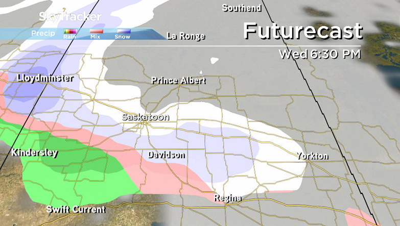
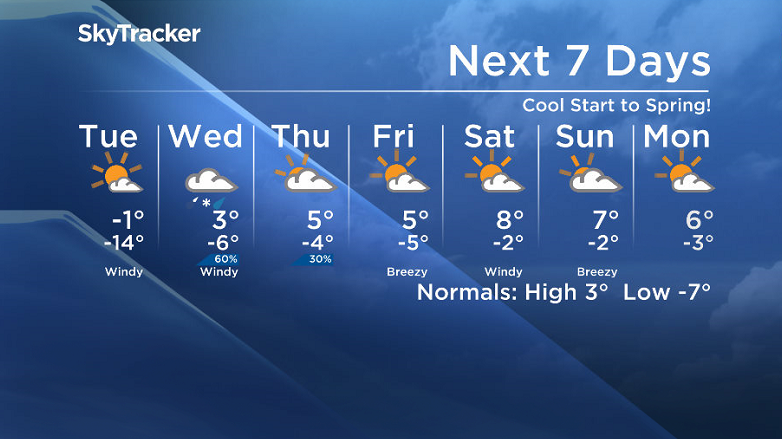
A low pressure system is expected to pass through on Wednesday that will bring with it a good chance of a few centimetres of snow with some rain potentially mixed in.
There isn’t great agreement on the type of precipitation at this point, so we will be watching this closely, however temperatures are likely to top out just above freezing during the day.
Behind that system, calmer conditions will slip in for the rest of the week under partly to mostly cloudy skies with afternoon highs up returning back into positive single digits.


Weekend Outlook
The weekend is still a ways away, however daytime highs look like they may be as warm as high single digits or low double digits under partly to mostly cloudy skies with a slight chance of showers.
Linda Phillips took this Your Saskatchewan photo at Last Mountain Lake:

Saskatoon weather outlook is your source for Saskatoon’s most accurate forecast and is your one stop shop for all things weather for central and northern Saskatchewan with comprehensive, in depth analysis that you can only find here.
Comments