

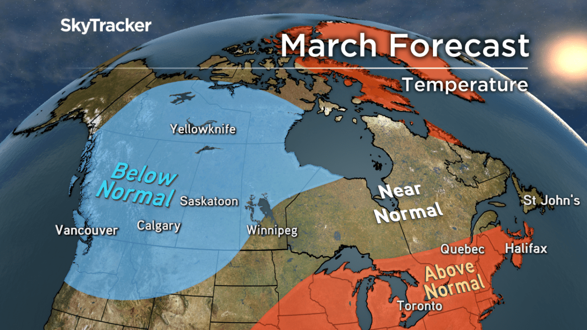
While parts of the country have enjoyed unusually balmy February temperatures, meteorologists are predicting a return of frigid winter weather for the start of March before giving way to spring-like temperatures in April and May.

“Winter will not disappear quietly in March,” said Global News chief meteorologist Anthony Farnell. “Massive swings in temperature will continue with cold once again building across northern and western Canada and transition of seasons providing frequent pushes of spring warmth up from the southern US. This will lead to a very active storm track with significant snow returning to the Prairies and a rain/snow mix for Ontario and Quebec.”


Geoff Coulson, a meteorologist with Environment Canada, also forecasts more winter on the way with colder temperatures returning to the Toronto area Thursday morning.
“We do have more mild air for today and Wednesday. If we reach the forecast high of 15 C for Toronto on Wednesday that would be a new record for March 1,” Coulson said. “But right after that that mild air gives way to another blast of Arctic air Wednesday night into Thursday morning.”
Global’s forecast shows Toronto commuters can expect a Thursday morning temperature of roughly -7 C before rising to a daytime high of -1 C.
The cold snap will continue into the weekend with an early Saturday morning temperature of -14 C before returning to warmer temperatures of around 5 C for Sunday and Monday.
Coulson said the colder temperatures forecast for Ontario and Quebec will also make their way eastward to the Atlantic Provinces.
“It’s a little too early to say spring is here, a little too early to be taking the snow tires off the cars and putting your parka away,” he said. “We still have a long way to be go before we declare spring anywhere in Canada, even having had the incredible warmth that we experienced here in southern Ontario in the last week.”


READ MORE: The snow race is on: Vancouver’s snowfall total for this winter could soon surpass Edmonton’s
The Prairies will see colder temperatures throughout the week with more moderate temperatures arriving by the weekend. B.C. will see temperatures this week hovering around 8 C with showers expected for Vancouver this weekend.
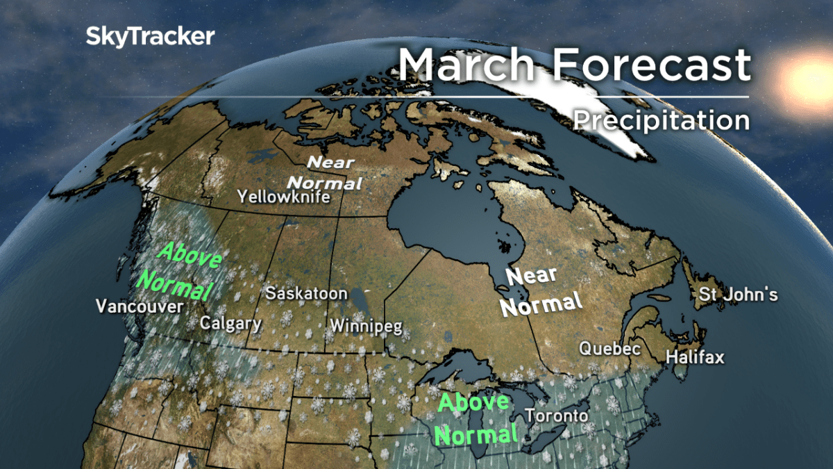
When looking at the longer-term forecast, residents of southern Ontario, Quebec, the Atlantic provinces, Yukon, Northwest Territories and Nunavut can expect near normal temperatures and precipitation this spring.
“How we get to those seasonal values could mean some stretches of colder than normal weather followed by stretches of milder than normal weather,” Coulson said.
This past winter was one of the “wildest and warmest east of the Rockies” according to Farnell, with the heaviest snow confined to both coasts.
“Vancouver and even Victoria have seen more snow than many cities across the prairies and southern Ontario while on the east coast Halifax residents just experienced the snowiest February on record,” Farnell said.
“Torontonians are living through their warmest February on record dating back to the late 1930’s and only 30cm of snow has fallen since January 1st. Meanwhile, Montrealers haven’t seen a February this mild since 1998.”
*With a file from the Canadian Press
Comments