
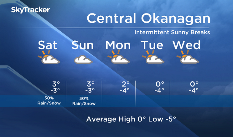
Friday, January 20, 2017 – Weather forecast update at 4pm:

A pair of lows over the Pacific will direct clouds into our region this weekend. Periodic sunny breaks are also possible in between the bands of clouds moving in from the south.
The email you need for the day's
top news stories from Canada and around the world.
As both of these lows are expected to stall offshore to the southwest, the precipitation will remain isolated in the Central Okanagan, North Okanagan, Shuswap and Columbia regions over the next few days.
A higher risk of precip is in the weekend forecast for the Similkameen, South Okanagan and Boundary regions.

This weekend’s daytime high range: 0 to +6
We will have the rest of your weather details coming up at 5 and 6:30 and 11pm – Hope you can join us!
~ Duane/Wesla
More on Canada
- Life in the forest: How Stanley Park’s longest resident survived a changing landscape
- ‘Love at first sight’: Snow leopard at Toronto Zoo pregnant for 1st time
- Buzz kill? Gen Z less interested in coffee than older Canadians, survey shows
- Carbon rebate labelling in bank deposits fuelling confusion, minister says
Comments