
Friday, January 20, 2017 – Weather forecast update at 5am:

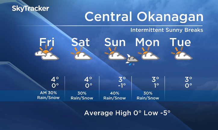
A pattern with some uncertainty is setting up. A low will form over the Pacific, but signs suggest that it will stall offshore to the southwest, resulting in drier conditions for the Central Okanagan, North Okanagan, and Shuswap regions with only a small chance of isolated precipitation over the next few days. Keep an eye out for intermittent sunny breaks!
A greater possibility of precipitation is in store for the South Okanagan, Similkameen and the Boundary regions as these areas will be closest to the centre of this low.
The long range forecast for next week calls for an upper ridge, and we will likely see a benign inactive weather pattern for all of the BC Southern Interior after Sunday.


Today’s daytime high range: 0 to +6
We will have the rest of your weather details coming up at 5 and 6:30 and 11pm – Hope you can join us!
~ Duane/Wesla
Comments