
Thursday, January 12, 2017 – Weather forecast update at 4pm:

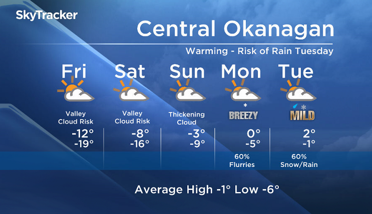
Waking up to valley cloud Thursday morning was a good indication that we will wake up to valley cloud again Friday morning as the temperature inversion will continue to strengthen while warmer air moves in aloft.
The possibility of afternoon clearing will decrease with a stronger inversion on Friday and Saturday.
A weakening front pushing inland on Saturday night will be the first attempt by Mother Nature to break down the inversion. Expect mid and high level clouds to develop through the weekend.
A more organized system late Monday and Tuesday will bring in the chance of precipitation. As freezing levels rise next week, we could see mixed precipitation and temperatures above freezing in the valley by Tuesday.


Friday’s daytime high range: -14 to -7
We will have the rest of your weather details coming up at 5 and 6:30 and 11pm – Hope you can join us!
~ Duane/Wesla
- Freeland set to table 2024 federal budget in the House of Commons
- All a-boot tradition: A look at finance ministers’ budget shoes through the years
- Inflation ticked higher in March. Are Bank of Canada rate cuts still in the cards?
- Food service strike: Air Canada, WestJet refine menus at Toronto Pearson
Comments