
Friday, November 25, 2016 – Weather forecast update at 4:30pm:

The next weather is moving up from the southwest. The centre of the low will track across Washington State this Saturday, and circulation around the low will direct clouds and bands of precip into our region.
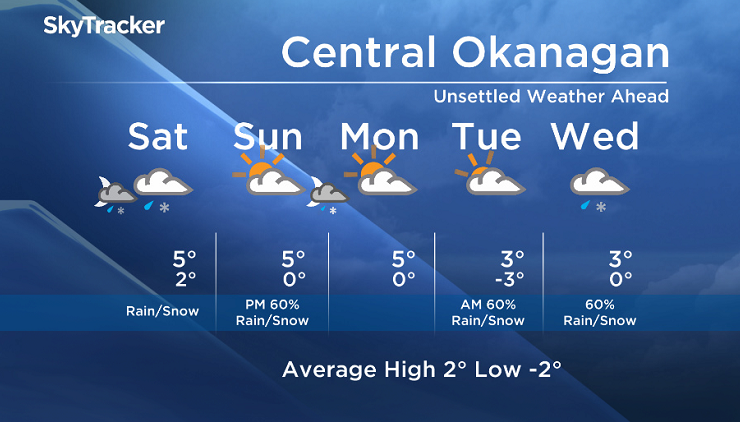
Freezing levels will be near valley bottom on Saturday morning and then rise to 1000m. A mix of rain and snow is likely for early Saturday morning, even for some valley elevations. The Southern Interior mountain passes will see a decent amount of snow starting overnight Friday and into Saturday.
We will see a brief break Sunday morning, but a switch to a northwesterly flow by Sunday evening will bring back the threat of rain and snow Sunday night.


This weekend’s daytime high range: 2 to 8C
We will have the rest of your weather details coming up at 5 and 6:30 and 11pm – Hope you can join us!
~ Duane/Wesla
Comments