
Monday, November 21, 2016 – Weather forecast update at 4:30pm:

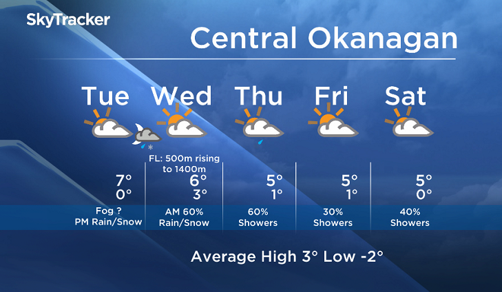
Tuesday will be dry to start, but a more active weather pattern will begin midweek.
A series of weather systems will move into the BC Interior starting Tuesday night until at least the weekend.
With freezing levels falling to near or slightly above valley levels in the overnight hours, wet flurries are possible for the valleys through the early morning hours on Wednesday.
On Wednesday afternoon we will be in between weather systems, but another low will advance into BC on Thursday with more showers likely.


Our forecast confidence after Thursday is low, but an unsettled weather pattern is expected through the weekend under a broad upper trough.
Tuesday’s daytime high range: 3 to 8C
We will have the rest of your weather details coming up at 5 and 6:30 and 11pm – Hope you can join us!
~ Duane/Wesla
- Roll Up To Win? Tim Hortons says $55K boat win email was ‘human error’
- Bird flu risk to humans an ‘enormous concern,’ WHO says. Here’s what to know
- Halifax homeless encampment hits double capacity, officials mull next step
- Ontario premier calls cost of gas ‘absolutely disgusting,’ raises price-gouging concerns
Comments