
Rain and thunderstorms to kickoff your weekend tomorrow!

Severe Thunderstorm Watch
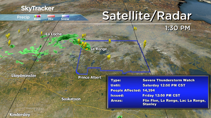
A severe thunderstorm watch has been issued for the La Ronge, Pelican Narrows and Prince Albert National Park areas.
Environment Canada says conditions are favourable for the development of severe thunderstorms that could produce strong winds, large hail and heavy rain this afternoon and evening in these areas.
Saskatoon Forecast
Today
After some rain moved through overnight, clouds cleared out early this morning to give us a beautiful, sunny start to the day!
Temperatures started out around 17 degrees before boosting up into the mid-20s by noon, feeling like the high 20s with humidity heading into the early afternoon.
The mercury is expected to top out in the high 20s with humidex values into the low 30s once again today with a continuation of the mostly sunny skies through the rest of the day.
Tonight
The clouds will move in tonight with rain beginning by early morning as temperatures dip back into the mid-teens.
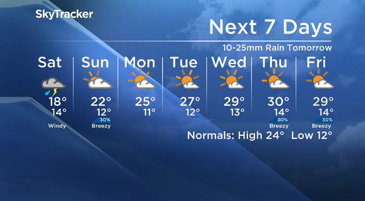
Saturday
Tomorrow could begin with a bang as models project some of the heaviest rain with the potential for embedded thunderstorms to move through early in the morning.
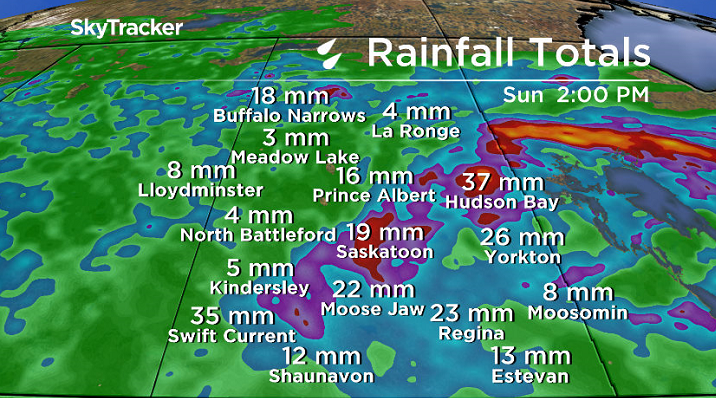
Parts of eastern Saskatchewan could see upwards of 40 millimetres as heavy rain lingers through the day.


Cloud cover, rain and a risk of thunderstorms will continue through the day with winds picking up late in the day to sustained speeds around 30 gusting upwards of 50 km/h into the evening.
Temperatures will remain cool as well, likely to top out in the mid-to-high teens.
Sunday
On the backside of this low pressure system, we’ll see some clearing with just a chance of morning rain and the winds easing through the day.
Late in the day there’s a slight risk of afternoon showers or thunderstorms, however we are expecting our daytime high to return to the 20s to round off the weekend.
Work Week Outlook
A ridge of high pressure will build back in the sunshine and heat next week with daytime highs pushing back into the high 20s, possibly even into the low 30s some days under partly to mostly sunny skies.
This Your Saskatchewan photo was taken by Dianne Mursell near Regina Beach:

Saskatoon weather outlook is your one stop shop for all things weather for Saskatoon, central and northern Saskatchewan with a comprehensive, detailed look at your local forecast that you can only find here.
Comments