
Tuesday, June 14, 2016 – Weather forecast update at 4:30pm:

The upper low that is currently over parts of BC has aided in lowering freezing levels and we have seen winter weather conditions for some of the high elevation areas in the Southern Interior.
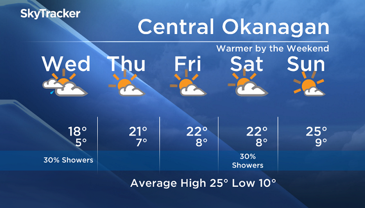
If you are travelling, keep in mind the potential for snow remains for some of the higher mountain passes Tuesday night and Wednesday morning.
The upper low will weaken and divide Wednesday, bringing a drier and slightly warmer weather pattern to our region for the second half of the work week.
There is still moderate uncertainty about the weather this weekend, but we are leaning towards a warmer trend.


Wednesday’s daytime high range: 14 to 20C
We will have the rest of your weather details coming up at 5 and 6:30 and 11pm – Hope you can join us!
~ Duane/Wesla
- Budget 2024 failed to spark ‘political reboot’ for Liberals, polling suggests
- Peel police chief met Sri Lankan officer a court says ‘participated’ in torture
- Wrong remains sent to ‘exhausted’ Canadian family after death on Cuba vacation
- Liberals having ‘very good’ budget talks with NDP, says Freeland
Comments