
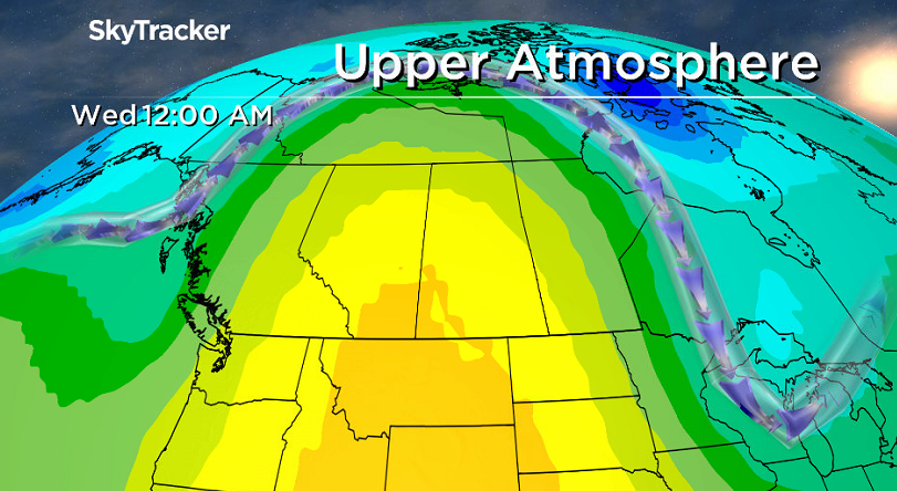
SASKATOON – Sizzling 30-degree heat is settling into Saskatoon this week with not a drop of rain in sight, raising fire risk. A massive ridge of high pressure in the upper atmosphere is to blame for the heat streak.

There is little to no significant precipitation in sight in the forecast ahead.
Temperatures are expected to climb into the mid-20s Monday, the high 20s Tuesday and then push up into the 30s both Wednesday and Thursday.
Saskatoon is likely to shatter what is almost a century-old record from 1918 on Wednesday if thermometers climb up above 30.0 degrees.
Another history-making day may be in the mix for Thursday if the mercury makes it above 31.5, which is the previous record from 1992. The current forecast high that day is 31 degrees, but climbing to 32 degrees is not out of the question.
As a cold front slides through Saskatoon late in the week, the city may see a sprinkling of rain, but that will be quickly sucked up into the soil or evaporated by the precipitation-parched air.
The result will be whatever rain does fall likely won’t make much of an impact to the fire danger situation, especially with a return to the heat expected to quickly follow with daytime highs once again pushing back into the high 20s this weekend.
READ MORE: RM of Paddockwood issues fire ban after 2 grass fires
The fire danger rating is likely to remain extreme across the region, into the Prince Albert area and extend north and northwest for the remainder of the week and likely continue to expand as any moisture present in the province will quickly evaporate due to the extremely low moisture content in the air.
Extreme fire danger is a fire risk rating made by Natural Resources Canada and means that fires that do spark up will be fast moving and difficult to control.
READ MORE: Fire danger extreme in parts of Saskatchewan, Alberta
This weather pattern with a massive upper ridge is more typical to late-summer, August-type weather for the region.
This year’s El Niño that brought a much warmer than normal winter is proving to continue to wreak havoc on temperature trends into the spring.
Saskatoon has seen an unprecedented warm year, with every single month trending above normal since last August.
This is typical of an El Niño pattern and the remainder of spring looks like it will keep up the mild trend, according to long-range forecast models.

Comments