
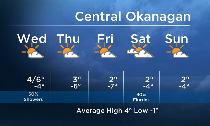
We will see partial clearing in the wake of the cold front today.

Most areas will see sun tomorrow with a few clouds, although areas near the mountains will see more cloud at times.
Cooler air will also move in, bringing overnight temps down below freezing over the next several days.
A drier weather pattern is in store until Friday with no significant weather systems moving in from the Pacific, and only isolated pockets of precip are expected.
There is some uncertainty for the weekend as a low is expected to track across Washington State. Whether we will see rain or snow this weekend will depend on how far south this frontal system will track.


Today’s daytime high range: 1 to 8C
We will have the rest of your weather details coming up at 5 and 6:30pm – Hope you can join us!
~ Duane/Wesla
- Life in the forest: How Stanley Park’s longest resident survived a changing landscape
- ‘Love at first sight’: Snow leopard at Toronto Zoo pregnant for 1st time
- Buzz kill? Gen Z less interested in coffee than older Canadians, survey shows
- Carbon rebate labelling in bank deposits fuelling confusion, minister says
Comments