
Weather update: Thursday July 23rd 3:45pm

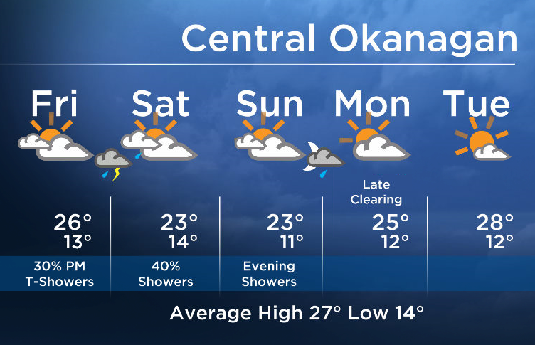
This month has seen one upper low after another drop into BC. Every time this happens, we see temps fall to near or slightly below seasonal, and this is exactly what will happen again this weekend.
As for Friday, expect a mix of sun and cloud to start in the early morning, but then increasing cloud throughout the day. There will be a small risk of showers/thundershowers late in the day on Friday.
Temps will gradually fall down to the low to mid 20’s by Saturday. The cooler air moving in aloft will generate bands of showers with the risk of thundershowers. We have put in a daily risk of showers starting late Friday and through the weekend.


An upper ridge will build in early next week, bringing back a more stable weather pattern by late Monday.
Friday’s daytime high range: 21 to 28C
More details coming up at 5, 6:30 and 11pm!
~ Duane/Wesla
- Train goes up in flames while rolling through London, Ont. Here’s what we know
- Budget 2024 failed to spark ‘political reboot’ for Liberals, polling suggests
- Wrong remains sent to ‘exhausted’ Canadian family after death on Cuba vacation
- Peel police chief met Sri Lankan officer a court says ‘participated’ in torture
Comments