
Weather update: Monday June 29th 4pm

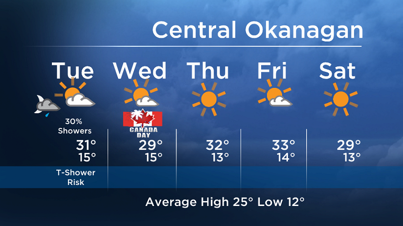
A pocket of cooler air aloft will generate showers and isolated thundershowers Monday and Tuesday. Sunshine will also be in the mix so be prepared for varied conditions.
The chance of showers/thundershowers will start to decrease on Tuesday (30% for the Okanagan/Boundary and 60% for the Shuswap/Columbia) and by Canada Day Wednesday our weather pattern will have stabilized and we will see mostly sunny conditions.
The email you need for the day's
top news stories from Canada and around the world.
When the upper ridge rebounds for the second half of the work week, some areas will climb back up into the low to mid 30’s by midweek.


Tuesday’s daytime high range: 26 to 33C
More details coming up at 5, 6:30 and 11pm!
~ Duane/Wesla
Comments