
Weather update: Friday June 26th 4pm

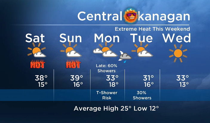
An extremely strong upper ridge will bring temps at least 10 to 15 degrees above seasonal this weekend. This translates to the BC Southern Interior heating up into the mid 30’s to low 40’s.
The email you need for the day's
top news stories from Canada and around the world.
A weak upper trough will bring temps down a few degrees on Monday and Tuesday, but daytime highs will still stay near the upper 20’s to mid 30’s. This disturbance will also bring us the chance of showers and thundershowers late in the date on Monday.


By Canada Day the ridge could rebound to bring us temps close to the mid 30’s again.
The weekend’s daytime high range: 33 to 41C
More details coming up at 5, 6:30 and 11pm!
~ Duane/Wesla
Comments