
SASKATOON – Don’t put the shovels away yet. Even though spring officially started in Saskatoon at 4:45 p.m. Friday, the first weekend of the new season will look much more like winter than anything Saskatoon has seen in weeks.

A weak, but fast moving low pressure system known as an Alberta clipper sped through the province overnight Thursday into Friday morning dropping a dusting of snow on the city.
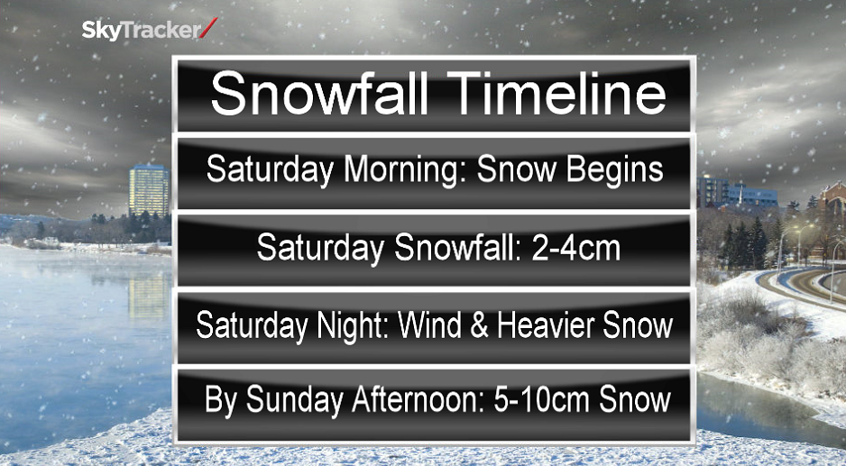
A more substantial dump of snow is slated to slide through this weekend with 2-4 centimetres of snow possible Saturday and an additional 5 to 10 centimetres possible by Sunday evening.
Winds will remain brisk this weekend during the snow event, with sustained speeds in the 20 to 30 km/h range and gusts upwards of 50 km/h.
Strongest winds are expected to coincide with the heaviest snowfall Saturday night into Sunday morning with gusts as high as 60 km/h possible overnight.
During heavier waves of snow, the wind may reduce visibility to near zero at times, causing poor travel conditions.
Along with the snow and wind will come sub-freezing daytime highs, which have been a rarity so far this month, with 13 out of the first 19 days of March seeing highs above zero.


The return to below freezing temperatures will encompass the first few days of the new season, but by next week, the mercury will recover back onto the positive side of the thermometer and much of the snow that falls this weekend will begin to melt.
Motorists planning to head out on roads are advised to use caution and check in with Saskatchewan Highway Hotline before heading out.
For weather on the go download the Global News Skytracker weather app for iPhone, iPad or Android.
- Budget 2024 failed to spark ‘political reboot’ for Liberals, polling suggests
- Train goes up in flames while rolling through London, Ont. Here’s what we know
- Peel police chief met Sri Lankan officer a court says ‘participated’ in torture
- Wrong remains sent to ‘exhausted’ Canadian family after death on Cuba vacation
Comments