
Weather update: Tuesday February 17th 4:15pm

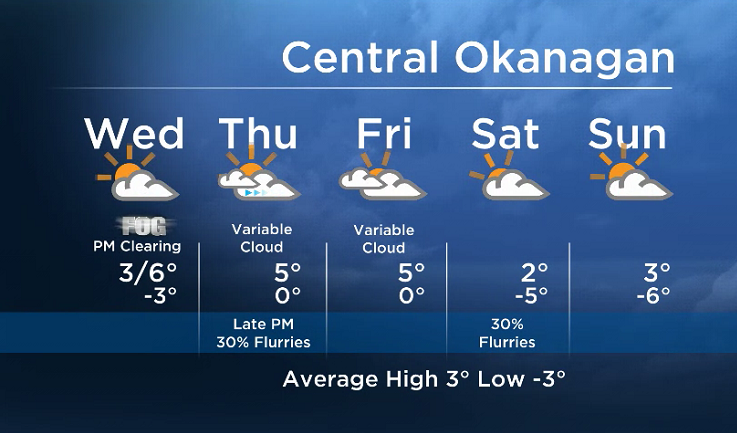
Morning fog with midday/afternoon clearing will once again be on tap for Wednesday.
Changes are ahead Thursday when the upper ridge over BC will flatten. This will open the door to mid and high clouds from a front that will push inland. Very light precipitation is possible Thursday night.
The email you need for the day's
top news stories from Canada and around the world.
A switch to a northerly influence on Friday and Saturday will bring us back down to seasonal temperatures by the weekend. A weak upper disturbance will bring us a slim chance of light flurries Saturday.


More details coming up at 5, 6:30 and 11pm!
Wednesday’s daytime high range: 2 to 9C
~ Duane/Wesla
More on Canada
- What is a halal mortgage? How interest-free home financing works in Canada
- Ontario doctors offer solutions to help address shortage of family physicians
- Capital gains changes are ‘really fair,’ Freeland says, as doctors cry foul
- LGBTQ2 rallies will be held across Canada next month. Here’s what to know
Comments