
Weather update: Friday January 30th 4:45pm

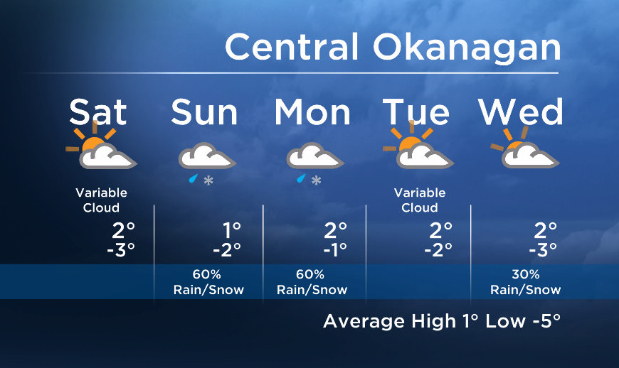
A weak disturbance will bring high clouds and a slight risk of isolated flurries to the area early Saturday morning, but by Saturday midday the sun will make a brief appearance behind this system.
The next system will push in Saturday late afternoon/evening and bring a wintery mix to the valley for Sunday. Most areas in the north where temperatures will be near or below freezing will likely see snow, while Central and Southern Okanagan areas will see wet flurries or a mix of rain and snow.


Another wave will move in from the west on Monday, bringing another round of precipitation to start the work week.
More details coming up at 5, 6:30 and 11pm!
Saturday’s daytime high range: -1 to 4C
Sunday’s daytime high range: -2 to 3C
~ Duane/Wesla
- Budget 2024 failed to spark ‘political reboot’ for Liberals, polling suggests
- Train goes up in flames while rolling through London, Ont. Here’s what we know
- Peel police chief met Sri Lankan officer a court says ‘participated’ in torture
- Wrong remains sent to ‘exhausted’ Canadian family after death on Cuba vacation
Comments