
TORONTO – As anyone who travels during the winter will tell you, having your flight delayed due to the whims of Mother Nature can be infuriating.

Well, online airline tracker FlightAware has a map that allows you to track just how bad the delays are.
READ MORE: LIVE BLOG: Eastern U.S., Canada preparing for potentially dangerous blizzard
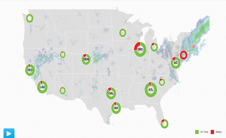
The “Misery Map” tracks inbound and outbound fights and calculates just how “miserable” it is to fly out of major airports across the United States based on the number of flights on time compared to flights that are delayed or cancelled.
The red indicates delays (misery) and green indicates flights without delays.
The “Blizzard of 2015” caused travel delays in the northeastern U.S. with some states issuing all out travel bans Monday. On Tuesday, New York and New Jersey lifted their bans after conditions improved.
A travel ban is still in place in Boston, which is receiving the brunt of the storm in the U.S. northeast.
READ MORE: LIVE BLOG: ‘Blizzard of 2015′ hits the Maritimes
As of Tuesday morning FlightAware had reported 169 cancellations and 158 delays.
Another online tracking site, Flightradar24, was also reporting several delays and even tweeted out a comparison.
The blizzard is expected to move out of the area early Wednesday morning.
Comments