
Weather update: Friday December 26th 4:15pm

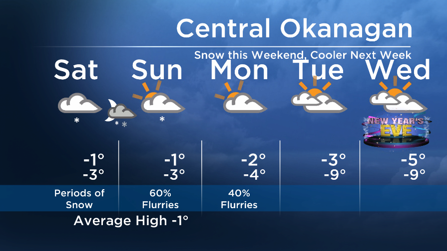
Temperatures will stay near or below freezing over the several days as our upper flow will be mainly from the north.
Embedded in this flow is an upper level disturbance that will bring snow to the area this weekend.
The email you need for the day's
top news stories from Canada and around the world.
The southern areas will see 1 to 4cm, and the central regions will see 2-6cm on Saturday. The snow will ease to flurries to Sunday/Monday when drier air will move in and sunshine will return.


An even cooler weather pattern is in store next week with temperatures well below freezing.
Have a great weekend.
Saturday’s daytime high range: -5 to +1C
Sunday’s daytime high range: -6 to 0C
~Wesla/Duane
More on Canada
- Roll Up To Win? Tim Hortons says $55K boat win email was ‘human error’
- Ontario premier calls cost of gas ‘absolutely disgusting,’ raises price-gouging concerns
- Bird flu risk to humans an ‘enormous concern,’ WHO says. Here’s what to know
- Election interference worse than government admits, rights coalition says
Comments